MyTopo
Crescent Lake SE Nebraska US Topo Map
Couldn't load pickup availability
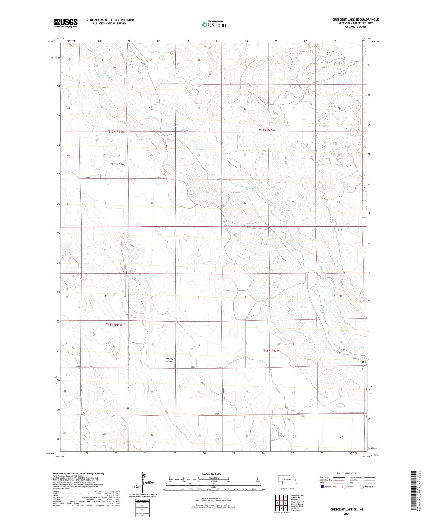
2021 topographic map quadrangle Crescent Lake SE in the state of Nebraska. Scale: 1:24000. Based on the newly updated USGS 7.5' US Topo map series, this map is in the following counties: Garden. The map contains contour data, water features, and other items you are used to seeing on USGS maps, but also has updated roads and other features. This is the next generation of topographic maps. Printed on high-quality waterproof paper with UV fade-resistant inks.
Quads adjacent to this one:
West: Sugar Loaf Hill
Northwest: Crescent Lake
North: Deer Lake
Northeast: Rackett
East: Gusher Spring
Southeast: Twin Buttes
South: Oshkosh
Southwest: Coumbe Bluff
This map covers the same area as the classic USGS quad with code o41102e3.
Contains the following named places: Antelope Valley, Antelope Valley School, Dogtown Flats, Garden County, Hutchinson School, Kingery Cemetery, Richstein Ranch