MyTopo
Courthouse Rock Nebraska US Topo Map
Couldn't load pickup availability
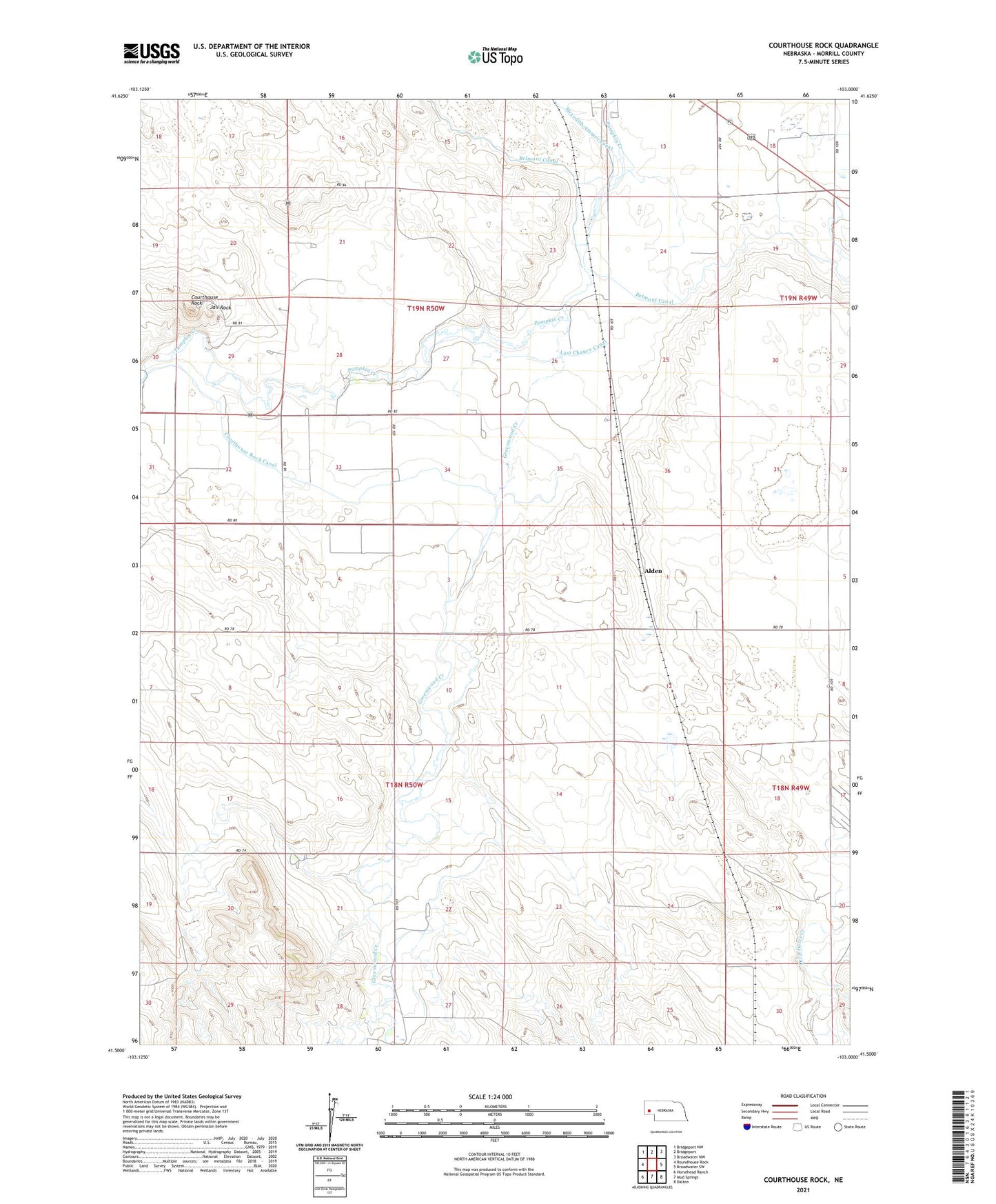
2021 topographic map quadrangle Courthouse Rock in the state of Nebraska. Scale: 1:24000. Based on the newly updated USGS 7.5' US Topo map series, this map is in the following counties: Morrill. The map contains contour data, water features, and other items you are used to seeing on USGS maps, but also has updated roads and other features. This is the next generation of topographic maps. Printed on high-quality waterproof paper with UV fade-resistant inks.
Quads adjacent to this one:
West: Roundhouse Rock
Northwest: Bridgeport NW
North: Bridgeport
Northeast: Broadwater NW
East: Broadwater SW
Southeast: Dalton
South: Mud Springs
Southwest: Horsehead Ranch
This map covers the same area as the classic USGS quad with code o41103e1.
Contains the following named places: Alden, Courthouse and Jail Rock Golf Course, Courthouse Rock, Courthouse Rock Canal, Courthouse Rock School, East Camp Clarke Election Precinct, Greenwood Creek, Greenwood Oil Field, Greenwood School, Harless-Ogard Dam, Harless-Ogard Reservoir, Hart Oil Field, Jail Rock, Last Chance Canal, Meredith Ammer Canal