MyTopo
Creighton Nebraska US Topo Map
Couldn't load pickup availability
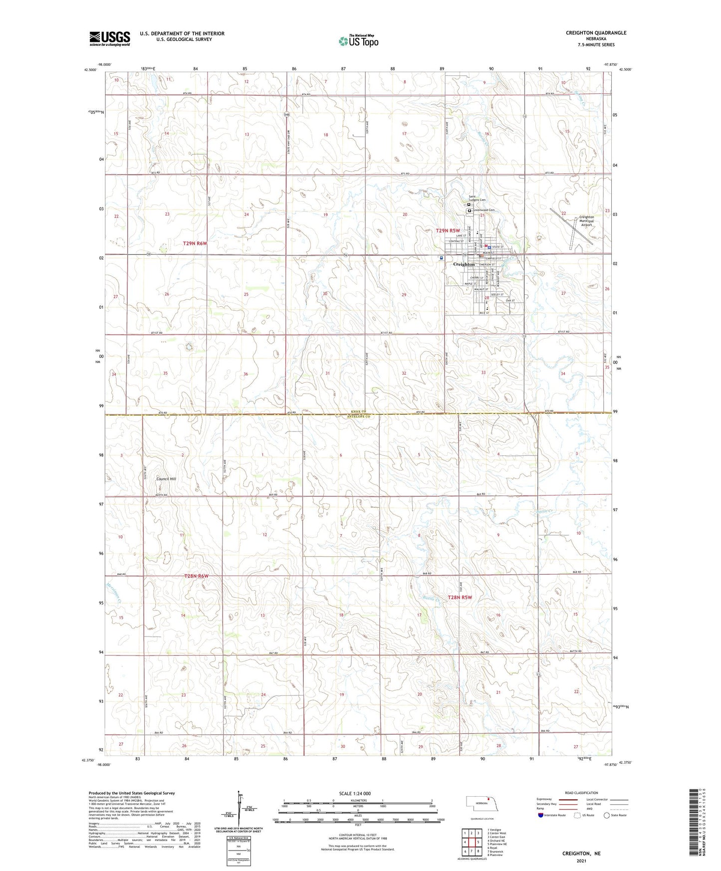
2021 topographic map quadrangle Creighton in the state of Nebraska. Scale: 1:24000. Based on the newly updated USGS 7.5' US Topo map series, this map is in the following counties: Knox, Antelope. The map contains contour data, water features, and other items you are used to seeing on USGS maps, but also has updated roads and other features. This is the next generation of topographic maps. Printed on high-quality waterproof paper with UV fade-resistant inks.
Quads adjacent to this one:
West: Orchard NE
Northwest: Verdigre
North: Center West
Northeast: Center East
East: Plainview NE
Southeast: Plainview
South: Brunswick
Southwest: Royal
Contains the following named places: Avera Creighton Hospital, Black Horse Inn Campground, Bruce Park, Bruce Park Campground, City of Creighton, Congregational Baptist Church, Council Hill, Creighton, Creighton Ambulance Service, Creighton Care Center, Creighton Community Golf Course, Creighton Family Dentistry, Creighton Municipal Airport, Creighton Police Department, Creighton Post Office, Creighton Public Library, Creighton Public School, Creighton Volunteer Fire Department, Faith Hope and Love Fellowship, Grace Bible Church, Greenwood Cemetery, Greg Paesi Memorial Field, Morrill Grain Company Incorporated Elevator, Saint Ludger Elementary School, Saint Ludgers Catholic Church, Saint Marks Episcopal Church, Township of Bazile, Township of Creighton, United Church of Christ, United Methodist Church, Zion Lutheran Church, ZIP Code: 68729