MyTopo
Royal Nebraska US Topo Map
Couldn't load pickup availability
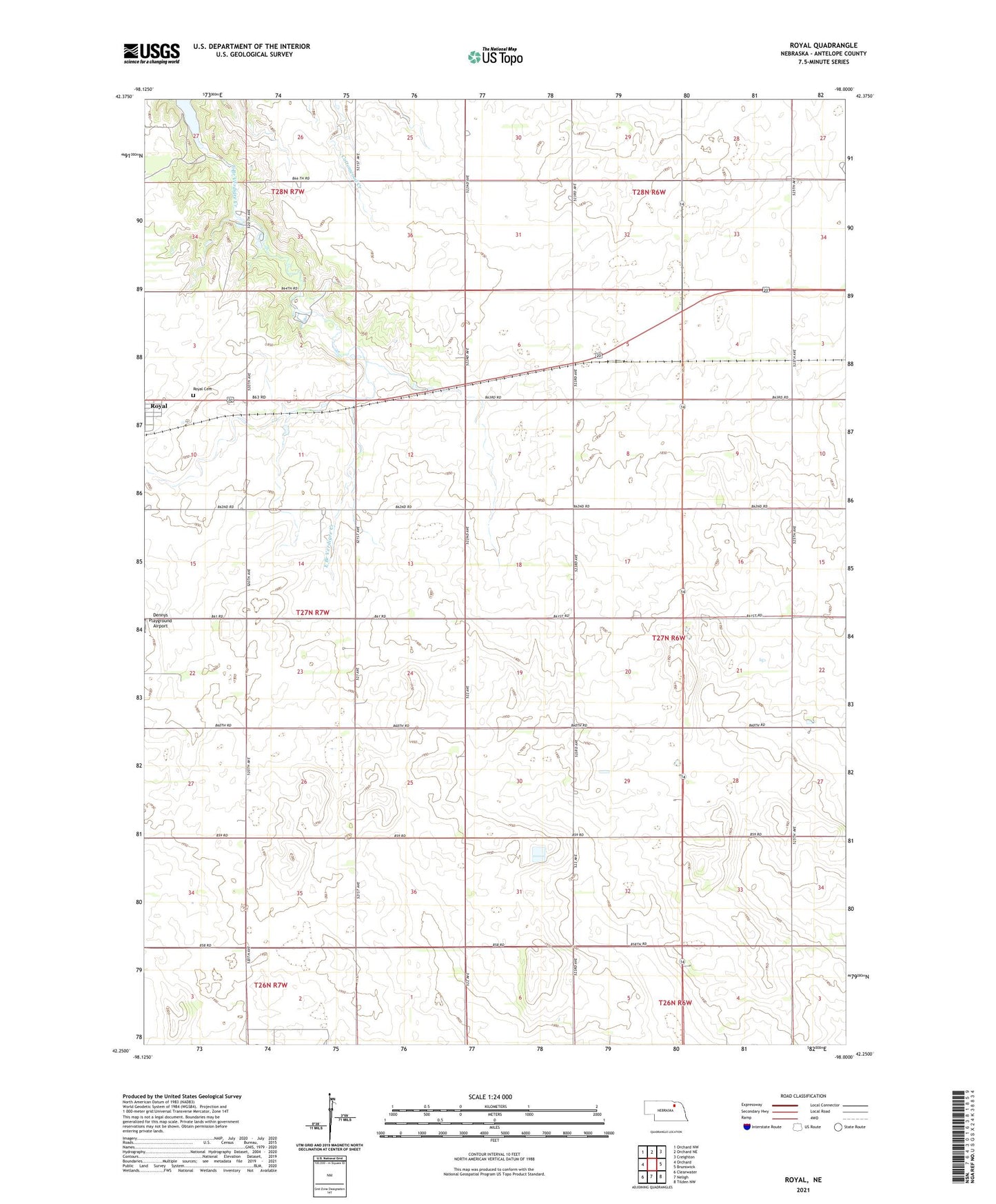
2021 topographic map quadrangle Royal in the state of Nebraska. Scale: 1:24000. Based on the newly updated USGS 7.5' US Topo map series, this map is in the following counties: Antelope. The map contains contour data, water features, and other items you are used to seeing on USGS maps, but also has updated roads and other features. This is the next generation of topographic maps. Printed on high-quality waterproof paper with UV fade-resistant inks.
Quads adjacent to this one:
West: Orchard
Northwest: Orchard NW
North: Orchard NE
Northeast: Creighton
East: Brunswick
Southeast: Tilden NW
South: Neligh
Southwest: Clearwater
This map covers the same area as the classic USGS quad with code o42098c1.
Contains the following named places: Grove Lake, Grove Lake State Fish Hatchery, Grove Lake State Wildlife Area, Hollylodge School, Northeast Nebraska Zoo, Royal Cemetery, Royal Elementary School, Royal Post Office, Royal Public Library, School Number 85, Sunny Side School, Township of Ellsworth, Valley View Public School, ZIP Codes: 68720, 68773