MyTopo
Crete South Nebraska US Topo Map
Couldn't load pickup availability
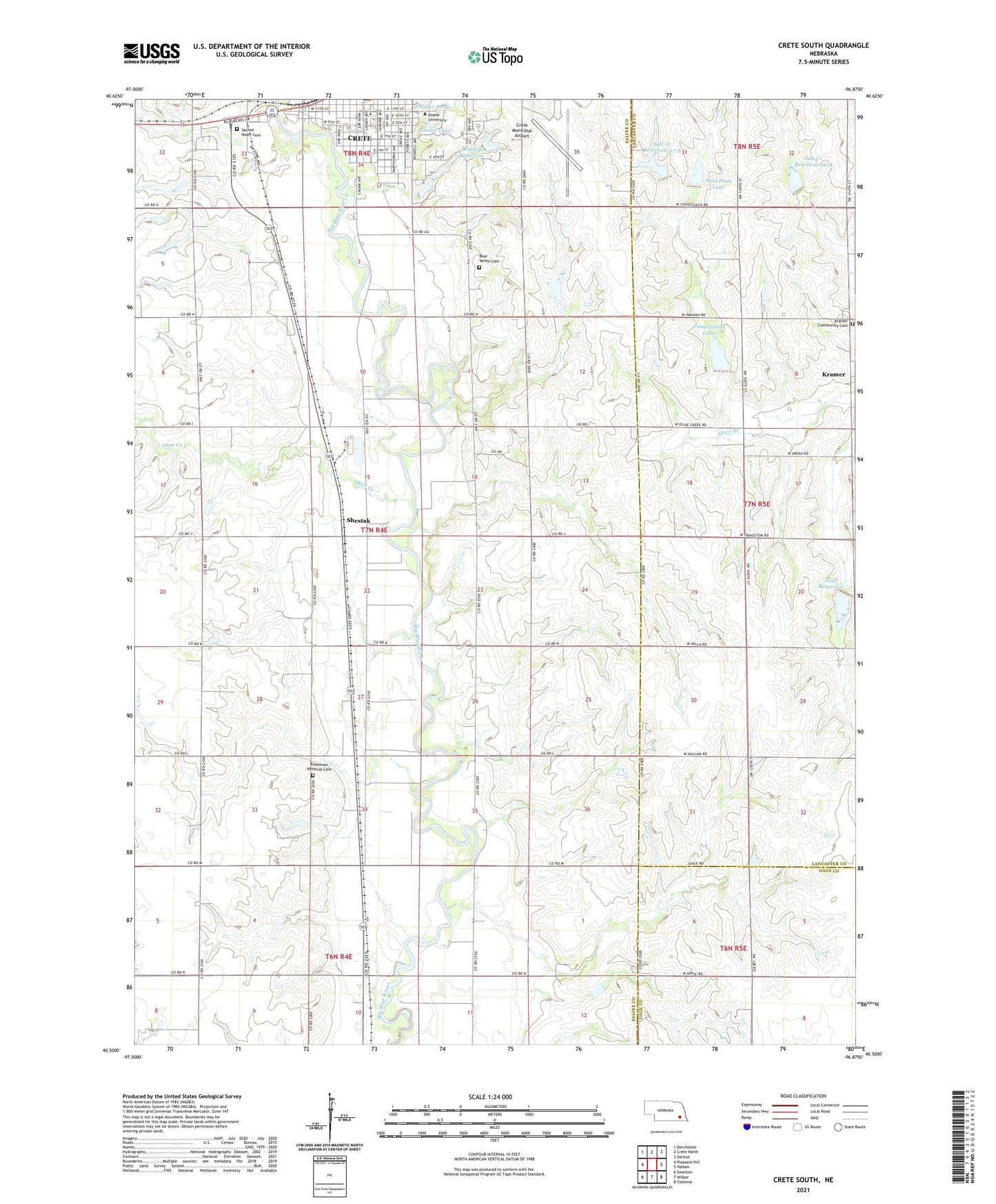
2021 topographic map quadrangle Crete South in the state of Nebraska. Scale: 1:24000. Based on the newly updated USGS 7.5' US Topo map series, this map is in the following counties: Saline, Lancaster, Gage. The map contains contour data, water features, and other items you are used to seeing on USGS maps, but also has updated roads and other features. This is the next generation of topographic maps. Printed on high-quality waterproof paper with UV fade-resistant inks.
Quads adjacent to this one:
West: Pleasant Hill
Northwest: Dorchester
North: Crete North
Northeast: Denton
East: Hallam
Southeast: Clatonia
South: Wilber
Southwest: Swanton
Contains the following named places: All American Rose Test Garden, Bauer House, Bertwell School, Bethlehem Lutheran Church, Big Blue Election Precinct, Big Blue School, Blue Valley Cemetery, Blue Valley Mental Health Center, Bohemian National Cemetery, Boswell Observatory, Boy Scout Camp, Burrage Hall, Butler Gymnasium and Pool, Cassell Open Air Theatre, Central Heating Plant, College Heights Country Club, Colonial Hall, Communications Building, Crete City Park, Crete Elementary School, Crete Junction, Crete Manor, Crete Medical Clinic, Crete Municipal Airport, Crete Vision Clinic, Crists Sky Ranch, Dean Pergola, Doane College, Doane Lake, Doane Village, Fairchild and Faculty Apartments, Faith Christian Church, First Congregational United Church of Christ, Fiske Lodge, Frees Hall, Fuhrer Fieldhouse, Gaylord Hall, Goodall Science Building, Grace United Methodist Church, Gregory Grove, Gus Stoll Park, Heart Cemetery, Kramer, Kramer Community Cemetery, Kramer Post Office, Lee Memorial Chapel and Whitcomb Conservatory, Little League Park, Lothrop Dam, Lothrop Reservoir, Merrill Tower, Miller Pond, North School, Otoe Creek, Padour-Walker Administration Building, Perkins Library, Perry Memorial Campus Center, Plymouth Congregational Church, Sacred Heart Cemetery, Saint Johns Lutheran Church, Saint Johns School, Salt Creek Dam 22-A, Salt Creek Dam 26-A, Salt Creek Dam 27-A, Salt Creek Dam 27-B, Salt Creek Dam 27-C, Salt Creek Reservoir 26-A, Salt Creek Reservoir 27-A, School Number 72, Sheldon Hall, Shestak, Shestak Post Office, Simon Field, Smith Hall, Tanglewood Lake, Taylor House, Teal Lake State Wildlife Management Area, Teal Reservoir, Township of Big Blue, Vilda School, Whitin Art Building, Wild Plum Lake, Wildwood Park, ZIP Code: 68333