MyTopo
Dorchester Nebraska US Topo Map
Couldn't load pickup availability
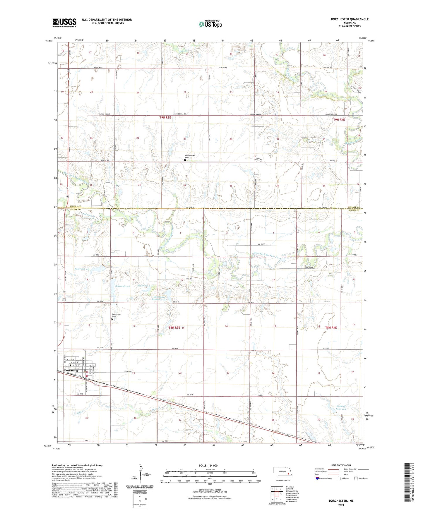
2021 topographic map quadrangle Dorchester in the state of Nebraska. Scale: 1:24000. Based on the newly updated USGS 7.5' US Topo map series, this map is in the following counties: Saline, Seward. The map contains contour data, water features, and other items you are used to seeing on USGS maps, but also has updated roads and other features. This is the next generation of topographic maps. Printed on high-quality waterproof paper with UV fade-resistant inks.
Quads adjacent to this one:
West: Dorchester NW
Northwest: Goehner
North: Milford
Northeast: Pleasant Dale
East: Crete North
Southeast: Crete South
South: Pleasant Hill
Southwest: Dorchester SW
This map covers the same area as the classic USGS quad with code o40097f1.
Contains the following named places: Blue Bluffs Dam, Blue Bluffs Reservoir, Blue River State Recreation Area, Blue Valley School, Detention Dam 1-A, Detention Dam 2-A, Detention Dam 3-A, Detention Dam 4-A, Diamond Public School, Dorchester, Dorchester Cemetery, Dorchester City Park, Dorchester Election Precinct, Dorchester Farmers Co-op Elevator, Dorchester Post Office, Dorchester Public Library, Dorchester Public Schools, Dorchester Reservoir 4-A, Dorchester Volunteer Fire and Rescue, Election Precinct O, Goldhammer Cemetery, Johnson Creek, Reservoir 1-A, Reservoir 2-A, Reservoir 3-A, Saline County Museum, Siedhoff Dam, Siedhoff Reservoir, Star School, Township O, Township of Dorchester, United Methodist Church, Village of Dorchester, West Blue Church