MyTopo
Swanton Nebraska US Topo Map
Couldn't load pickup availability
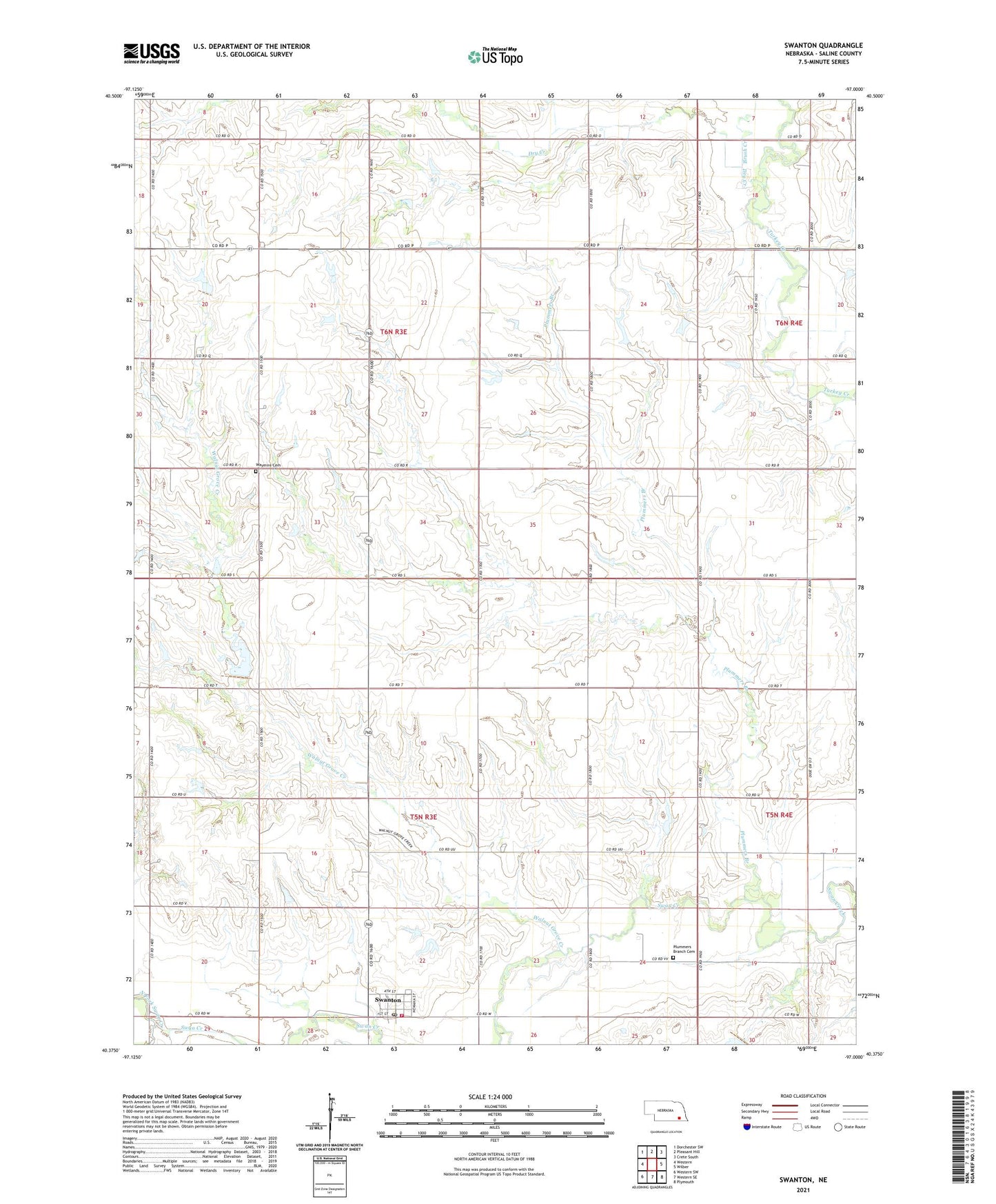
2021 topographic map quadrangle Swanton in the state of Nebraska. Scale: 1:24000. Based on the newly updated USGS 7.5' US Topo map series, this map is in the following counties: Saline. The map contains contour data, water features, and other items you are used to seeing on USGS maps, but also has updated roads and other features. This is the next generation of topographic maps. Printed on high-quality waterproof paper with UV fade-resistant inks.
Quads adjacent to this one:
West: Western
Northwest: Dorchester SW
North: Pleasant Hill
Northeast: Crete South
East: Wilber
Southeast: Plymouth
South: Western SE
Southwest: Western SW
This map covers the same area as the classic USGS quad with code o40097d1.
Contains the following named places: Bethel School, Brush Creek, Brush Creek Election Precinct, Cline School, Davisson School, Dry Creek, Farmers Co-op Elevator, Golden School, Green Valley School, Mumby School, North Fork Swan Creek, Pleasant Valley School, Plummers Branch, Plummers Branch Cemetery, Plummers Branch School, South Fork Swan Creek, Swan Creek Election Precinct, Swanton, Swanton City Park, Swanton Post Office, Swanton Volunteer Fire Department, Township of Brush Creek, Township of Swan Creek, United Methodist Church, Village of Swanton, Walnut Grove Creek, Waymire Cemetery, Waymire School, ZIP Codes: 68445, 68465