MyTopo
Davey Nebraska US Topo Map
Couldn't load pickup availability
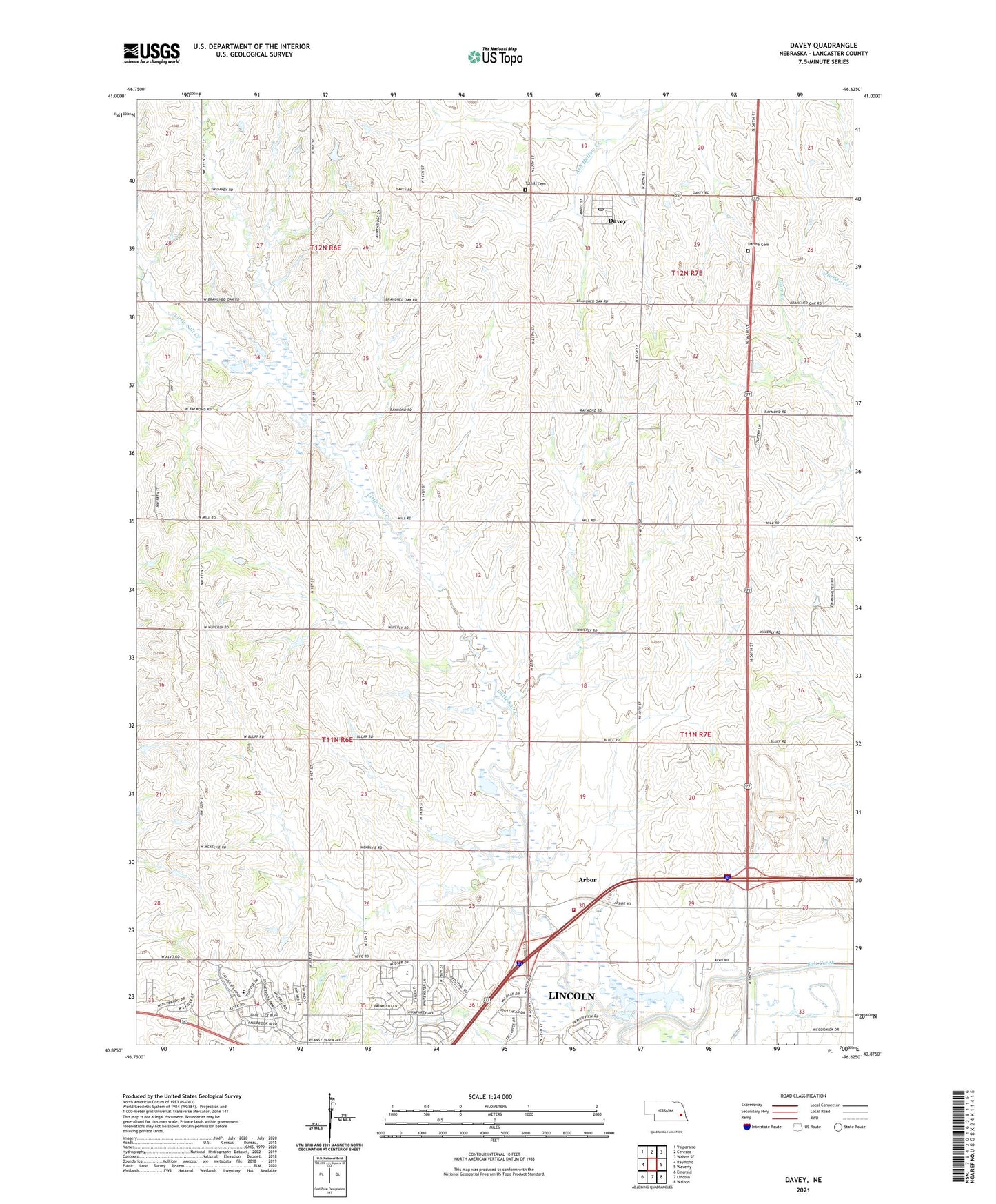
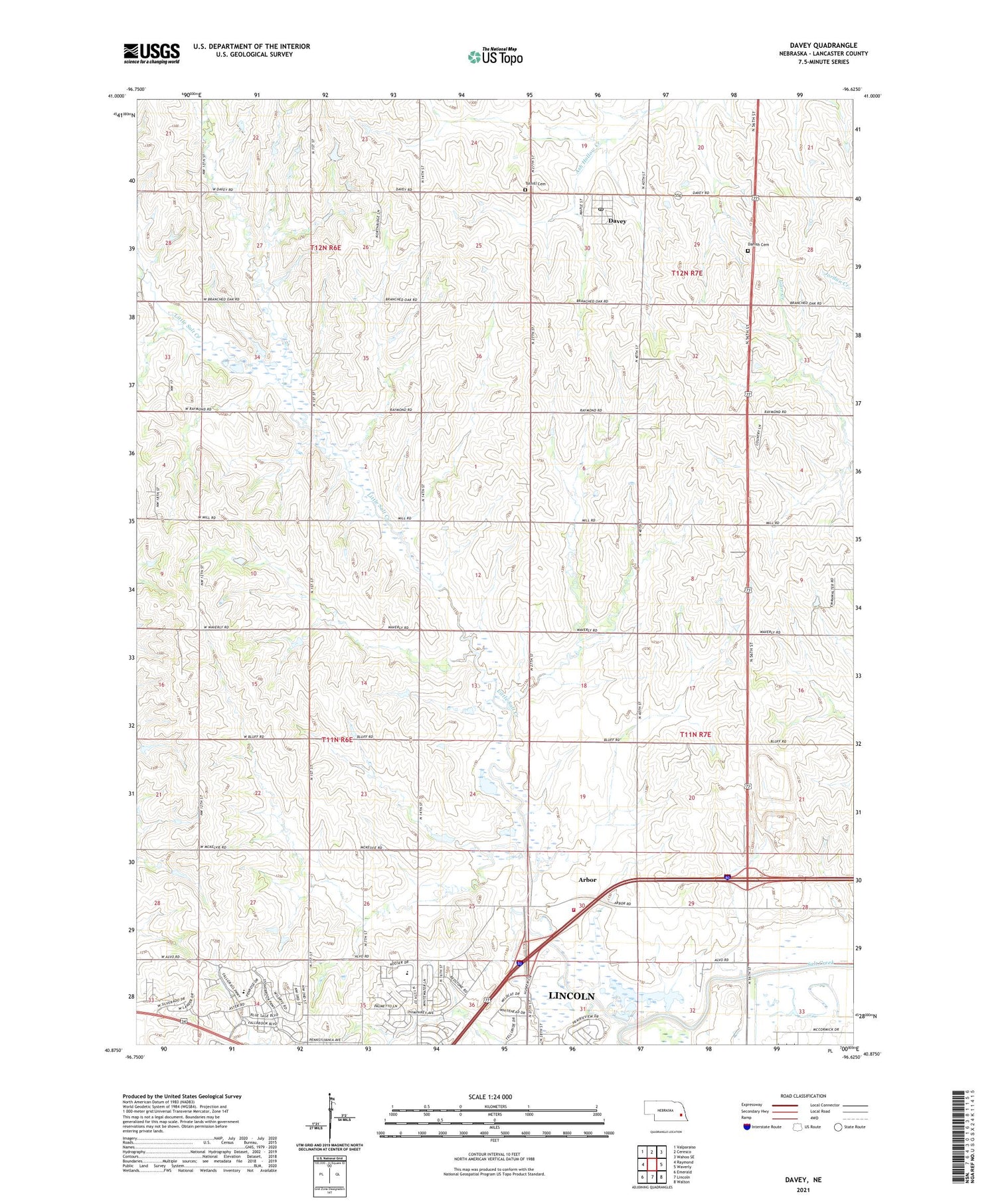
2021 topographic map quadrangle Davey in the state of Nebraska. Scale: 1:24000. Based on the newly updated USGS 7.5' US Topo map series, this map is in the following counties: Lancaster. The map contains contour data, water features, and other items you are used to seeing on USGS maps, but also has updated roads and other features. This is the next generation of topographic maps. Printed on high-quality waterproof paper with UV fade-resistant inks.
Quads adjacent to this one:
West: Raymond
Northwest: Valparaiso
North: Ceresco
Northeast: Wahoo SE
East: Waverly
Southeast: Walton
South: Lincoln
Southwest: Emerald
Contains the following named places: Arbor, Arbor Post Office, City of Lincoln Historical Marker, Danish Cemetery, Davey, Davey Post Office, Dream Field, James Arthur Vineyard, KLDZ-FM (Lincoln), Lincoln Rest Area, Little Salt Creek, Nebraskas Prairie Plants Historical Marker, Oak Election Precinct, Raymond Volunteer Fire Department - Arbor Station, Saint Mary Catholic Church, School Number 109, School Number 122, School Number 37, Tothill Cemetery, Township of Little Salt, Township of Oak, Village of Davey, Warbonnet AG Strip, ZIP Codes: 68336, 68514, 68531