MyTopo
Valparaiso Nebraska US Topo Map
Couldn't load pickup availability
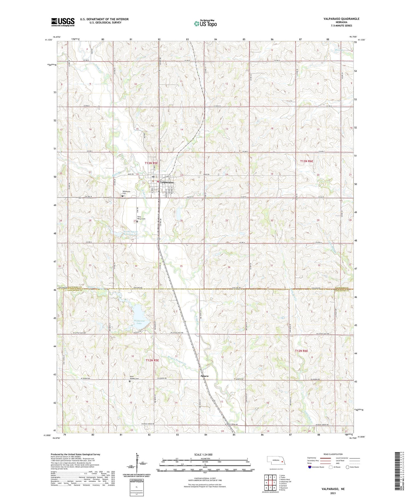
2021 topographic map quadrangle Valparaiso in the state of Nebraska. Scale: 1:24000. Based on the newly updated USGS 7.5' US Topo map series, this map is in the following counties: Saunders, Lancaster. The map contains contour data, water features, and other items you are used to seeing on USGS maps, but also has updated roads and other features. This is the next generation of topographic maps. Printed on high-quality waterproof paper with UV fade-resistant inks.
Quads adjacent to this one:
West: Valparaiso SW
Northwest: Loma
North: Touhy
Northeast: Wahoo West
East: Ceresco
Southeast: Davey
South: Raymond
Southwest: Garland
This map covers the same area as the classic USGS quad with code o41096a7.
Contains the following named places: Agnew, Agnew Census Designated Place, Agnew Post Office, Bates Branch, D and D Elevator, Indian Camp School, Jensen Cemetery, KZKX-FM (Seward), Mount Zion School, North Oak Creek, North Oak Creek Dam 1-A, North Oak Creek Dam 2-C, North Oak Creek Reservoir 2-C, North Star School, Novotny/Tonar Farms Airport, Novotnys Sky Ranch, Polaks Sky Ranch, Raymond Central Elementary School, Saint Joseph Cemetery, Saint Marys Cemetery, Saints Mary and Joseph Catholic Church, School Number 118, Township of Oak Creek, Valparaiso, Valparaiso Cemetery, Valparaiso Fire and Rescue, Valparaiso Post Office, Valparaiso Public Library, Village of Valparaiso, Wagon Tongue Creek, West Oak Election Precinct, Wildwood Lake, Wildwood Lake State Wildlife Management Area, ZIP Code: 68065