MyTopo
Dutch Creek Nebraska US Topo Map
Couldn't load pickup availability
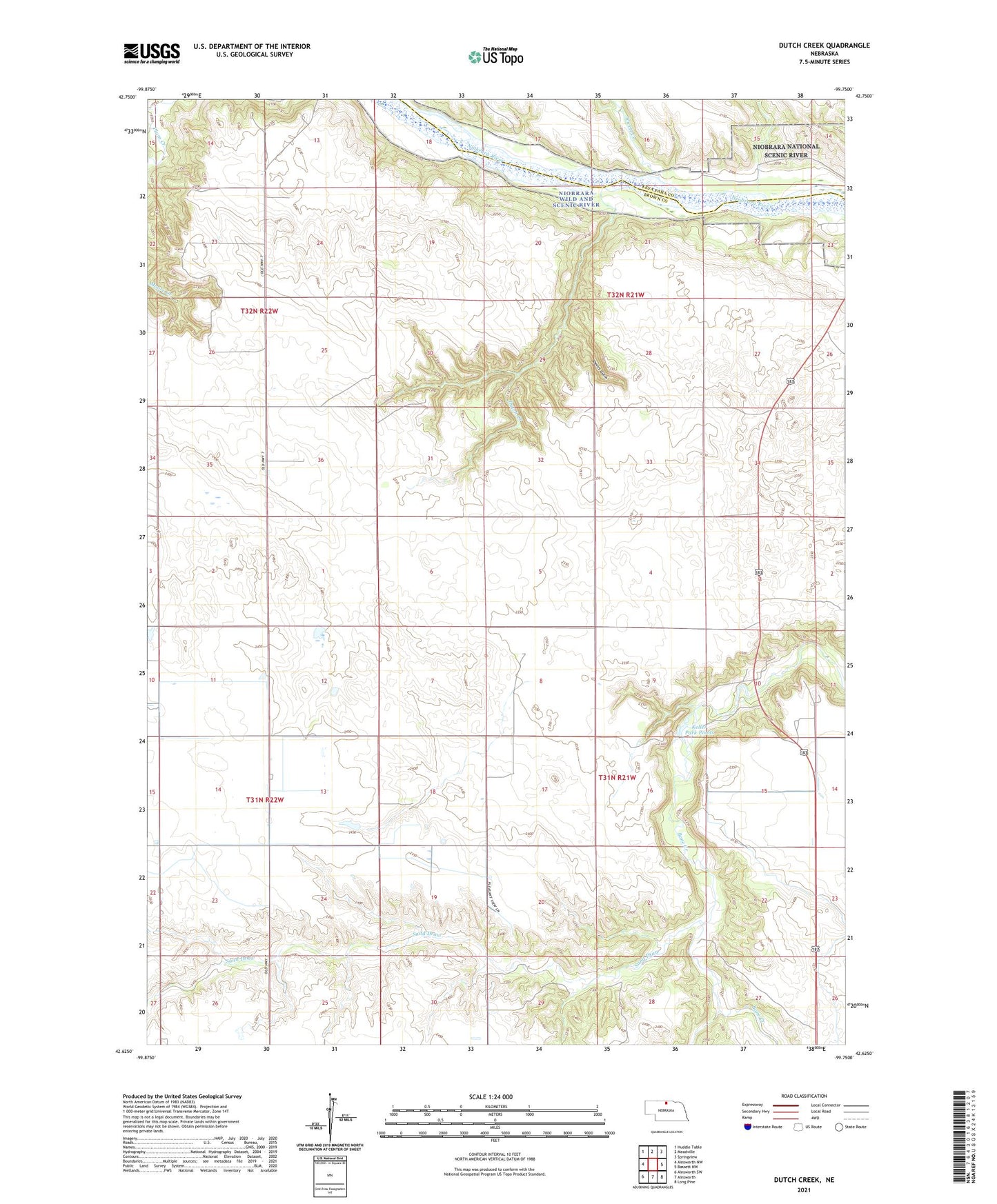
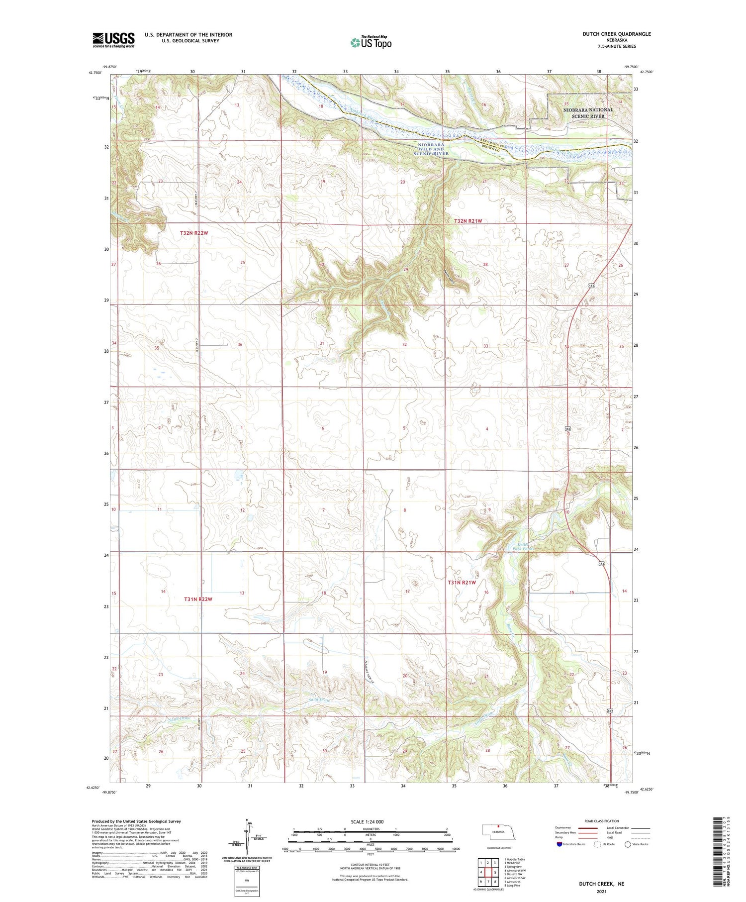
2021 topographic map quadrangle Dutch Creek in the state of Nebraska. Scale: 1:24000. Based on the newly updated USGS 7.5' US Topo map series, this map is in the following counties: Brown, Keya Paha. The map contains contour data, water features, and other items you are used to seeing on USGS maps, but also has updated roads and other features. This is the next generation of topographic maps. Printed on high-quality waterproof paper with UV fade-resistant inks.
Quads adjacent to this one:
West: Ainsworth NW
Northwest: Huddle Table
North: Meadville
Northeast: Springview
East: Bassett NW
Southeast: Long Pine
South: Ainsworth
Southwest: Ainsworth SW
Contains the following named places: Devils Gulch, Dutch Creek, Highland Church, Highland Grove Public School, Jewett Creek, Keller Park Ponds, Keller Park State Recreation Area, Keller Park Trail, Keller School Land State Wildlife Management Area, Park Row School, Sand Draw, School Number 11, School Number 35, School Number 57