MyTopo
Springview Nebraska US Topo Map
Couldn't load pickup availability
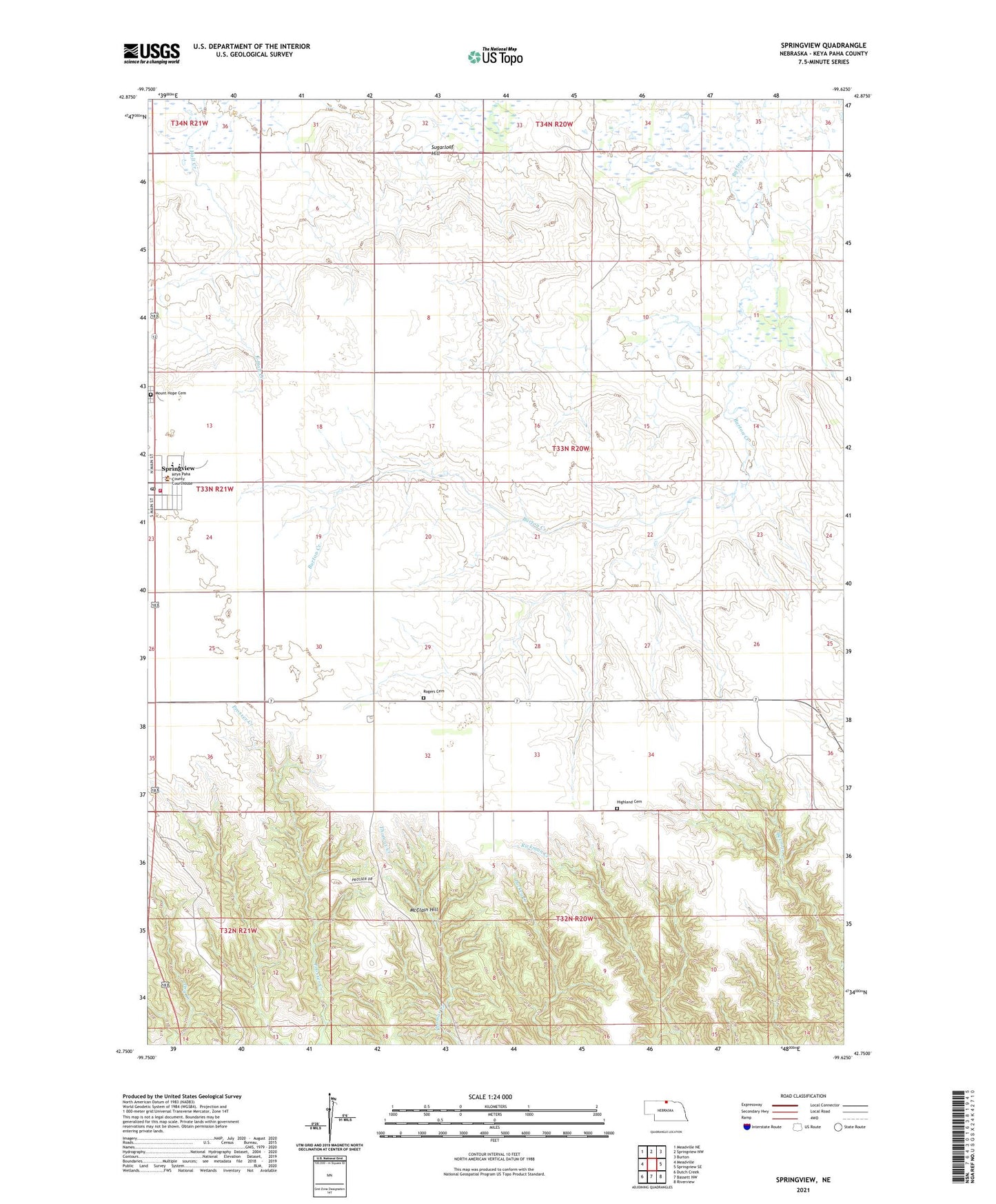
2021 topographic map quadrangle Springview in the state of Nebraska. Scale: 1:24000. Based on the newly updated USGS 7.5' US Topo map series, this map is in the following counties: Keya Paha. The map contains contour data, water features, and other items you are used to seeing on USGS maps, but also has updated roads and other features. This is the next generation of topographic maps. Printed on high-quality waterproof paper with UV fade-resistant inks.
Quads adjacent to this one:
West: Meadville
Northwest: Meadville NE
North: Springview NW
Northeast: Burton
East: Springview SE
Southeast: Riverview
South: Bassett NW
Southwest: Dutch Creek
This map covers the same area as the classic USGS quad with code o42099g6.
Contains the following named places: Assembly of God Church, Custer Election Precinct, Faith Chapel, Grace Lutheran Church, Green Valley School, Highland Cemetery, Keya Paha County Fair Grounds, Keya Paha County High School, Keya Paha County Library, Keya Paha County Sheriffs Office, Keya Paha County Sheriff's Office, Keya Paha Historical Society, McClain Hill, Mount Hope Cemetery, New Hope Community Church, Rogers Cemetery, Spring View Public School, Springview, Springview Fire and Rescue, Springview Municipal Airport, Springview Post Office, Sugarloaf Hill, Thomas Creek State Wildlife Management Area, United Methodist Church, Village of Springview