MyTopo
Eddyville Nebraska US Topo Map
Couldn't load pickup availability
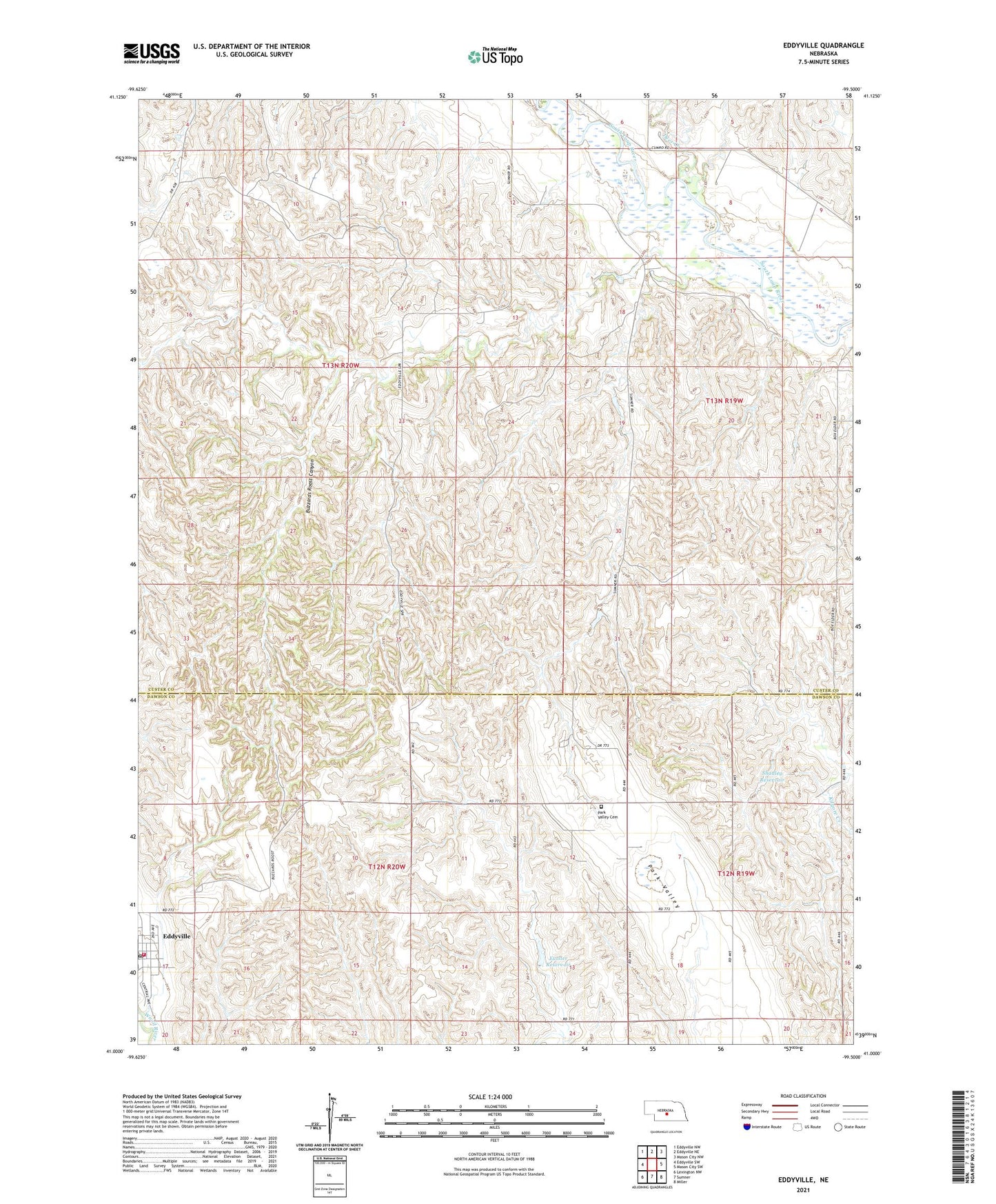
2021 topographic map quadrangle Eddyville in the state of Nebraska. Scale: 1:24000. Based on the newly updated USGS 7.5' US Topo map series, this map is in the following counties: Custer, Dawson. The map contains contour data, water features, and other items you are used to seeing on USGS maps, but also has updated roads and other features. This is the next generation of topographic maps. Printed on high-quality waterproof paper with UV fade-resistant inks.
Quads adjacent to this one:
West: Eddyville SW
Northwest: Eddyville NW
North: Eddyville NE
Northeast: Mason City NW
East: Mason City SW
Southeast: Miller
South: Sumner
Southwest: Lexington NW
Contains the following named places: Buzzards Roost Canyon, Deer Creek, Eddyville, Eddyville Post Office - CPO, Eddyville Rural Volunteer Fire Department, Eutsler Dam, Eutsler Reservoir, Hidden Hollow School, Mount Olive School, Park Valley Cemetery, Saint Patricks Catholic Church, Shadley Dam, Shadley Reservoir, United Methodist Church, Upper Park School, Village of Eddyville, Warm Swamp