MyTopo
Mason City SW Nebraska US Topo Map
Couldn't load pickup availability
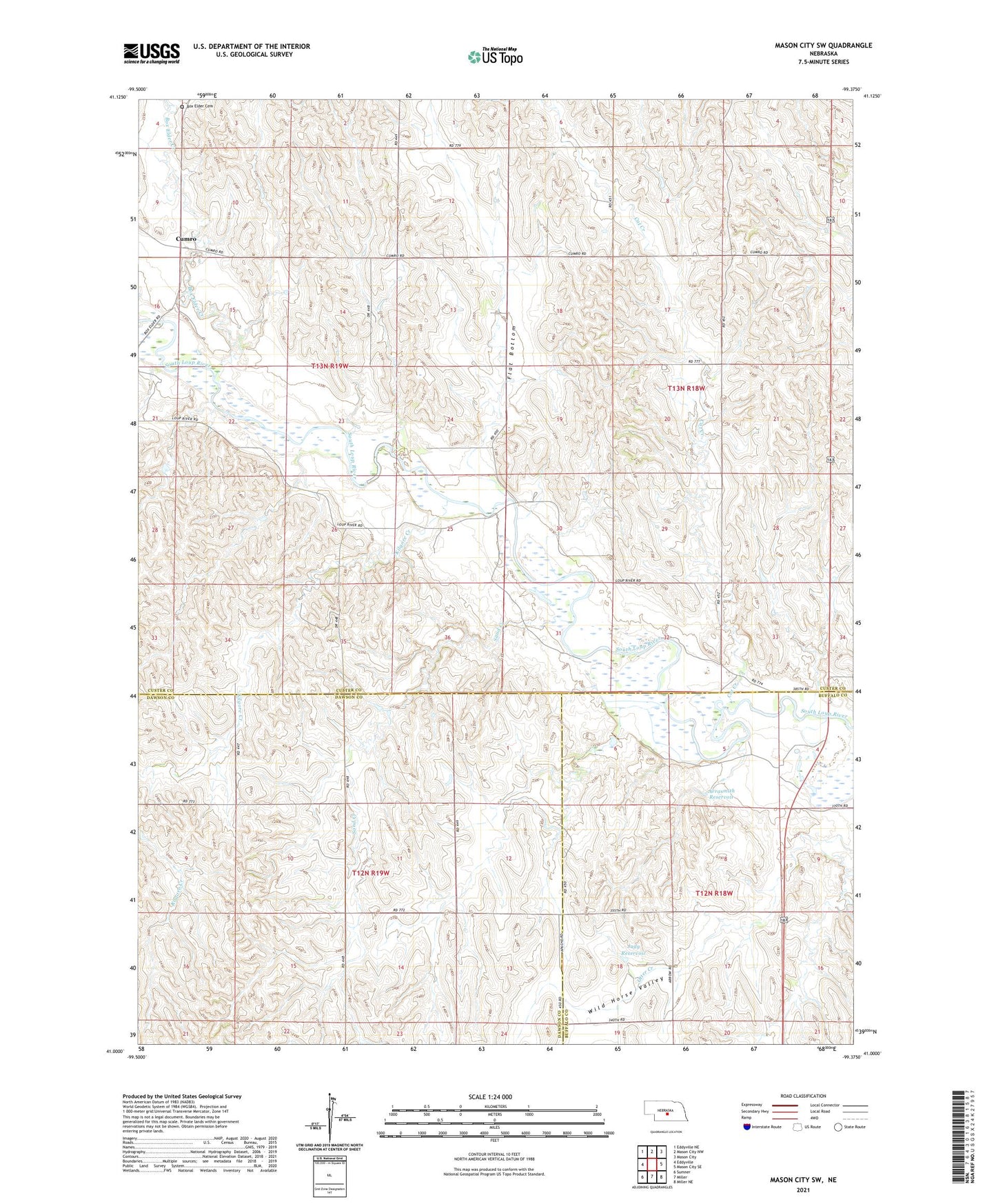
2021 topographic map quadrangle Mason City SW in the state of Nebraska. Scale: 1:24000. Based on the newly updated USGS 7.5' US Topo map series, this map is in the following counties: Custer, Dawson, Buffalo. The map contains contour data, water features, and other items you are used to seeing on USGS maps, but also has updated roads and other features. This is the next generation of topographic maps. Printed on high-quality waterproof paper with UV fade-resistant inks.
Quads adjacent to this one:
West: Eddyville
Northwest: Eddyville NE
North: Mason City NW
Northeast: Mason City
East: Mason City SE
Southeast: Miller NE
South: Miller
Southwest: Sumner
This map covers the same area as the classic USGS quad with code o41099a4.
Contains the following named places: Arrasmith Dam, Arrasmith Reservoir, Box Elder Cemetery, Box Elder Creek, Cat Creek, Cumro, Cumro Nebraska Historical Marker, Cumro Post Office, Cumro School, East Box Elder Creek, Flat Bottom, Flat Bottom School, Judy Dam, Judy Reservoir, Kilgore Creek, Lower Cat Creek, Milton Store, Otter Creek, Sand Creek, Sunny Slope School, Victory Hill School, West Box Elder Creek, Wild Horse School, Wild Horse Valley