MyTopo
Eddyville SW Nebraska US Topo Map
Couldn't load pickup availability
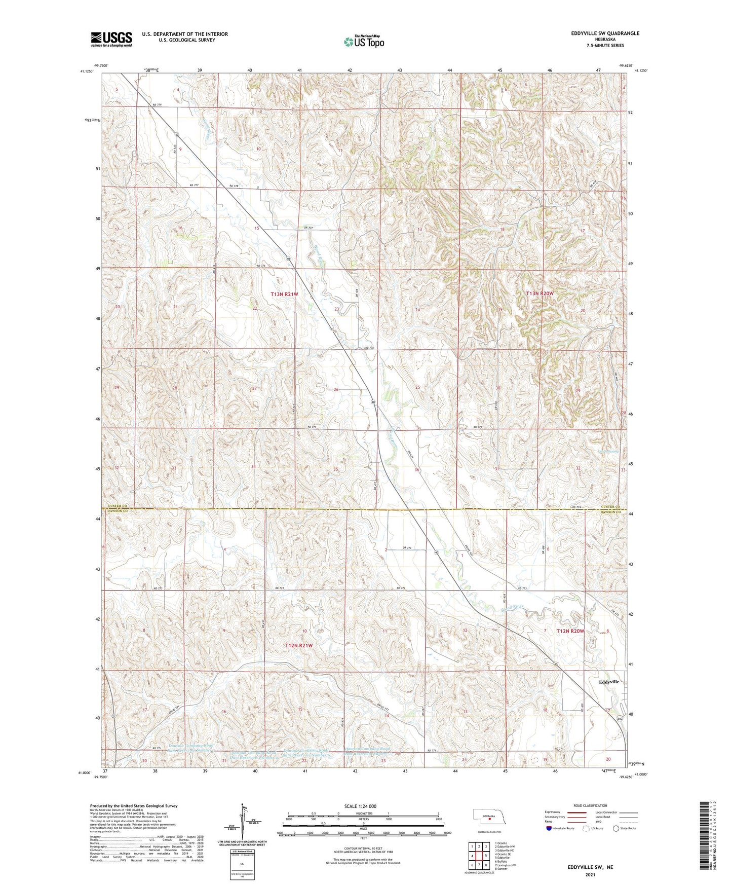
2021 topographic map quadrangle Eddyville SW in the state of Nebraska. Scale: 1:24000. Based on the newly updated USGS 7.5' US Topo map series, this map is in the following counties: Custer, Dawson. The map contains contour data, water features, and other items you are used to seeing on USGS maps, but also has updated roads and other features. This is the next generation of topographic maps. Printed on high-quality waterproof paper with UV fade-resistant inks.
Quads adjacent to this one:
West: Oconto SE
Northwest: Oconto
North: Eddyville NW
Northeast: Eddyville NE
East: Eddyville
Southeast: Sumner
South: Lexington NW
Southwest: Buffalo
This map covers the same area as the classic USGS quad with code o41099a6.
Contains the following named places: Buzzards Roost, Dawson Company Road Dam Number 3, Dawson Company Road Dam Number 4, Dawson Company Road Dam Number 5, Dawson Company Road Dam Number 6, Dawson Company Road Dam Number 7, Dawson Company Road Dam Reservoir Number 3, Dawson Company Road Dam Reservoir Number 4, Dawson Company Road Dam Reservoir Number 5, Dawson Company Road Dam Reservoir Number 6, Dawson Company Road Dam Reservoir Number 7, Eddyville, Happy Hollow School, Kennebec Election Precinct, School Number 245, School Number 65, Warn Swamp, ZIP Code: 68834