MyTopo
Elba Nebraska US Topo Map
Couldn't load pickup availability
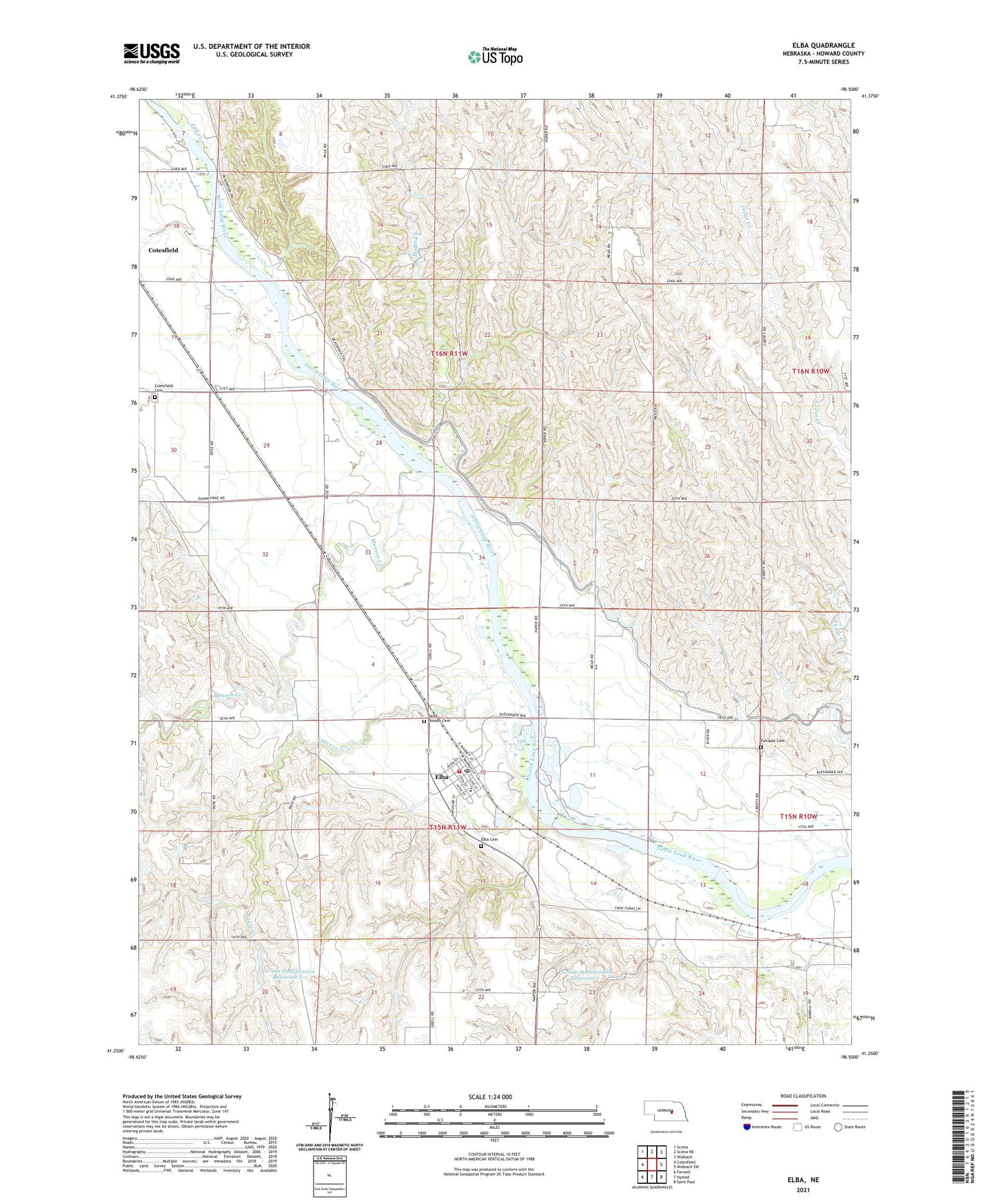
2021 topographic map quadrangle Elba in the state of Nebraska. Scale: 1:24000. Based on the newly updated USGS 7.5' US Topo map series, this map is in the following counties: Howard. The map contains contour data, water features, and other items you are used to seeing on USGS maps, but also has updated roads and other features. This is the next generation of topographic maps. Printed on high-quality waterproof paper with UV fade-resistant inks.
Quads adjacent to this one:
West: Cotesfield
Northwest: Scotia
North: Scotia NE
Northeast: Wolbach
East: Wolbach SW
Southeast: Saint Paul
South: Nysted
Southwest: Farwell
Contains the following named places: Auger Creek, Channel Block Reservoir 1-2, Channel Block-Tuma Crossing 1-2 Dam, Cotesfield Cemetery, Cotesfield Election Precinct, Elba, Elba Cemetery, Elba Election Precinct, Elba Post Office, Elba Public Schools, Elba Volunteer Fire and Rescue, Fairdale Cemetery, Farmers Grain and Supply Company of Elba Elevator, Fish Creek, Grade Stabilization Dam 1-1, Grade Stabilization Dam 2-1, Grade Stabilization Dam 2-3, Grade Stabilization Reservoir 1-1, Grade Stabilization Reservoir 2-1, Grade Stabilization Reservoir 2-3, Moffet Creek, Munson Creek, Saint Joseph Cemetery, Saint Josephs Church, School Number 2, School Number 54, Township of Cotesfield, Township of Elba, Township of Fairdale, United Methodist Church, Village of Elba, ZIP Code: 68835