MyTopo
Nysted Nebraska US Topo Map
Couldn't load pickup availability
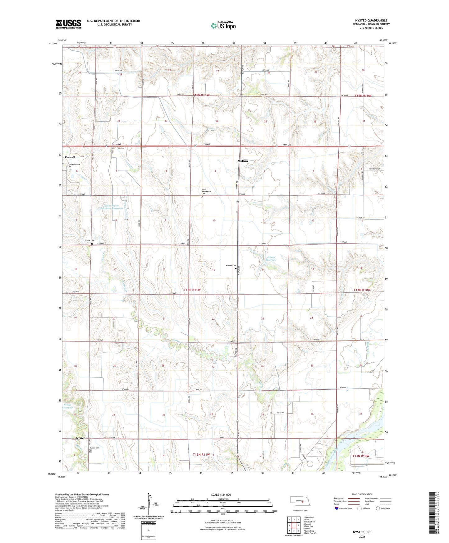
2021 topographic map quadrangle Nysted in the state of Nebraska. Scale: 1:24000. Based on the newly updated USGS 7.5' US Topo map series, this map is in the following counties: Howard. The map contains contour data, water features, and other items you are used to seeing on USGS maps, but also has updated roads and other features. This is the next generation of topographic maps. Printed on high-quality waterproof paper with UV fade-resistant inks.
Quads adjacent to this one:
West: Farwell
Northwest: Cotesfield
North: Elba
Northeast: Wolbach SW
East: Saint Paul
Southeast: Saint Paul SW
South: Dannebrog
Southwest: Boelus
This map covers the same area as the classic USGS quad with code o41098b5.
Contains the following named places: Cow Creek, Czechoslovakia Cemetery, Howard County, Jacobs Waste Treatment Dam, Jacobs Waste Treatment Reservoir, Jensen Dam, Jensen Reservoir, Midway, Nysted, Nysted Cemetery, Nysted Post Office, Ransom Dam, Ransom Reservoir, Saint Peders Lutheran Church, Saint Wenceslaus Cemetery, Saint Wenceslaus Cemetery Historical Marker, School Number 13, School Number 18, School Number 27, School Number 38, School Number 55, School Number 61, School Number 8, Scotch Cemetery, Township of Warsaw, Warsaw Cemetery, Warsaw Election Precinct