MyTopo
Elgin Nebraska US Topo Map
Couldn't load pickup availability
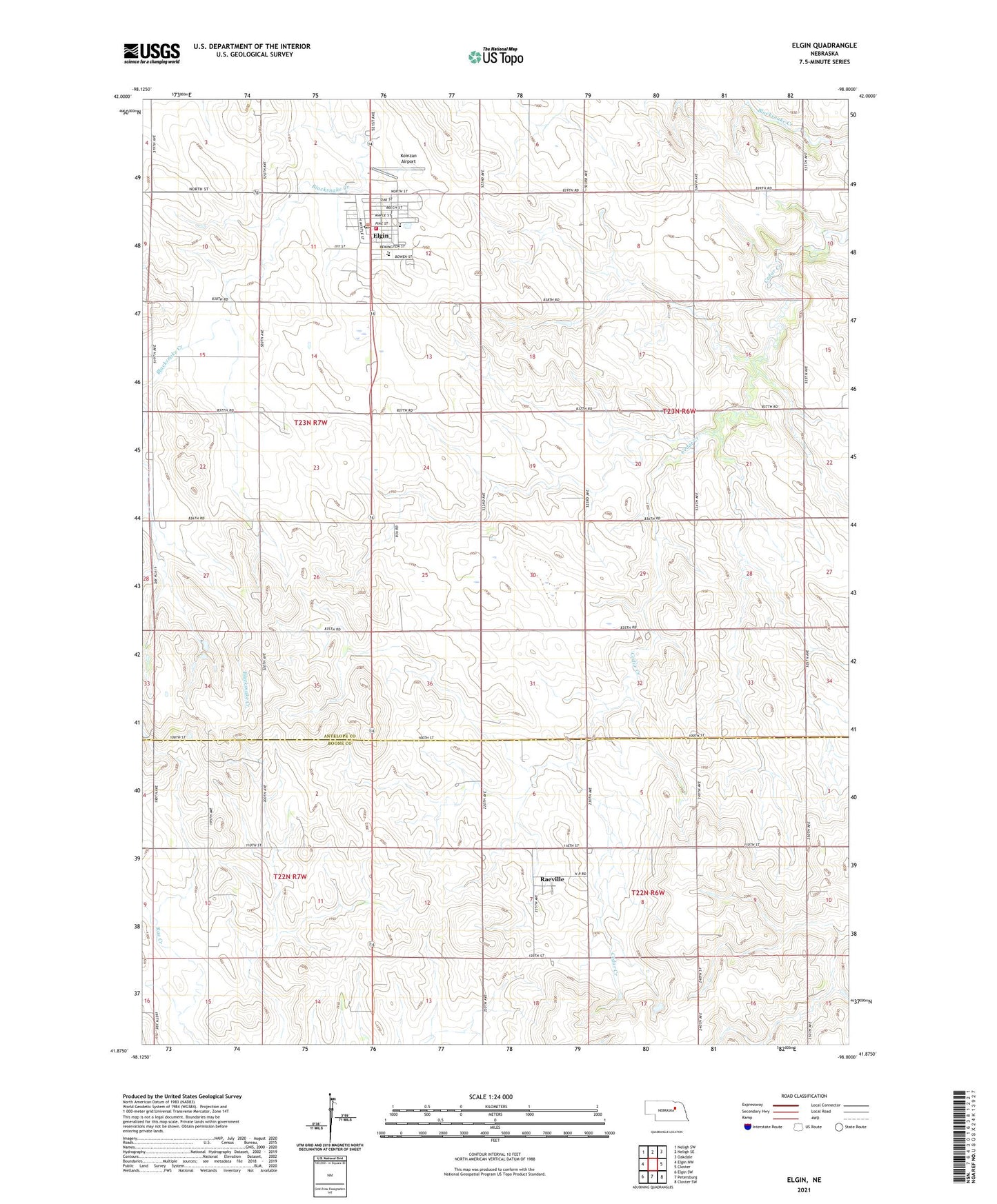
2021 topographic map quadrangle Elgin in the state of Nebraska. Scale: 1:24000. Based on the newly updated USGS 7.5' US Topo map series, this map is in the following counties: Antelope, Boone. The map contains contour data, water features, and other items you are used to seeing on USGS maps, but also has updated roads and other features. This is the next generation of topographic maps. Printed on high-quality waterproof paper with UV fade-resistant inks.
Quads adjacent to this one:
West: Elgin NW
Northwest: Neligh SW
North: Neligh SE
Northeast: Oakdale
East: Closter
Southeast: Closter SW
South: Petersburg
Southwest: Elgin SW
Contains the following named places: Antelope Memorial Hospital Elgin Clinic, Centennial Gardens, Central Farmers Cooperative Elevator, City of Elgin, Elgin, Elgin City Mall, Elgin Municipal Park, Elgin Municipal Park Campground, Elgin Police Department, Elgin Post Office, Elgin Public Library, Elgin Public Schools, Elgin Veterans Medical Clinic, Elgin Volunteer Fire Department, Koinzan Airport, Plantation House, Pope John XXIII High School, Raeville, Raeville Census Designated Place, Raeville Post Office, Saint Bonaventure Catholic Church, Saint Boniface Elementary School, Saint Boniface Parish, Township of Cedar, Township of Logan, Trinity Lutheran Church, United Methodist Church