MyTopo
Petersburg Nebraska US Topo Map
Couldn't load pickup availability
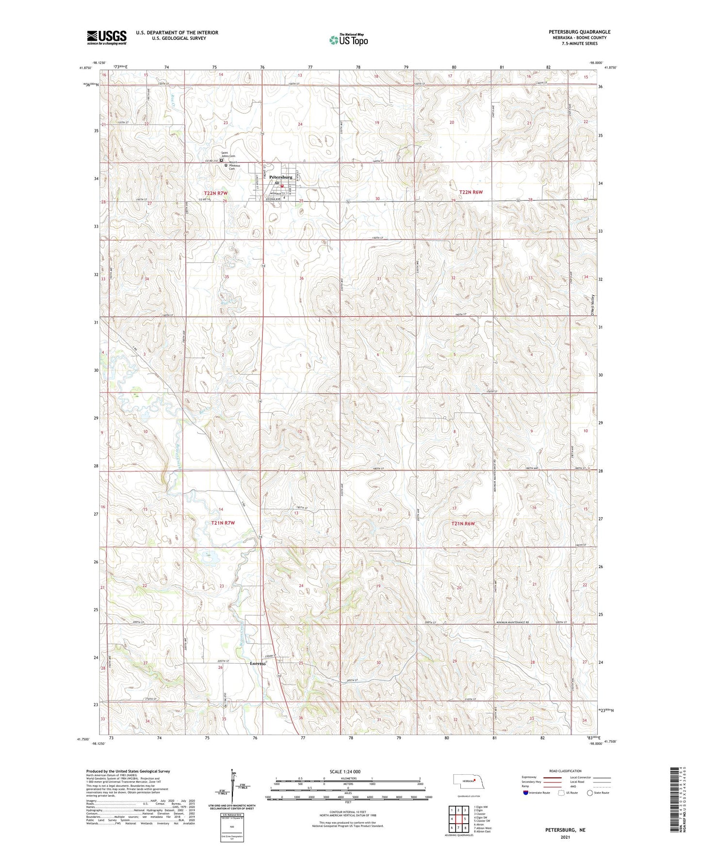
2021 topographic map quadrangle Petersburg in the state of Nebraska. Scale: 1:24000. Based on the newly updated USGS 7.5' US Topo map series, this map is in the following counties: Boone. The map contains contour data, water features, and other items you are used to seeing on USGS maps, but also has updated roads and other features. This is the next generation of topographic maps. Printed on high-quality waterproof paper with UV fade-resistant inks.
Quads adjacent to this one:
West: Elgin SW
Northwest: Elgin NW
North: Elgin
Northeast: Closter
East: Closter SW
Southeast: Albion East
South: Albion West
Southwest: Akron
This map covers the same area as the classic USGS quad with code o41098g1.
Contains the following named places: Central Farmers Cooperative Elevator, Logan Fontenelle Historical Marker, Loretto, Loretto Census Designated Place, Loretto Post Office, Mount Pleasant Cemetery, North Manchester Election Precinct, Petersburg, Petersburg City Park, Petersburg Elevator, Petersburg Police Department, Petersburg Post Office, Petersburg Public Library, Petersburg Public Schools, Petersburg Volunteer Fire Department, Rae Creek, Saint John the Baptist Catholic Church, Saint John the Baptist Elementary School, Saint Johns Cemetery, School Number 56, Spieker Dam, Spieker Reservoir, Village of Petersburg, ZIP Code: 68652