MyTopo
Oakdale Nebraska US Topo Map
Couldn't load pickup availability
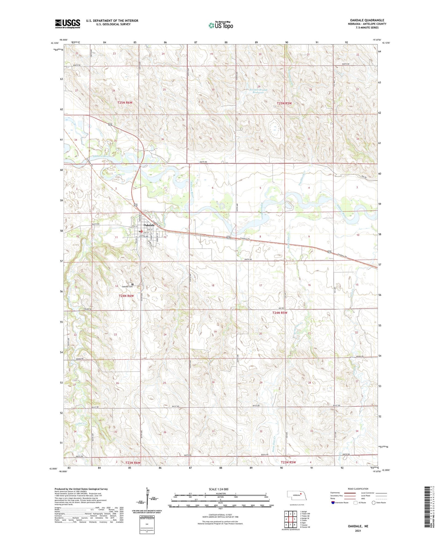
2021 topographic map quadrangle Oakdale in the state of Nebraska. Scale: 1:24000. Based on the newly updated USGS 7.5' US Topo map series, this map is in the following counties: Antelope. The map contains contour data, water features, and other items you are used to seeing on USGS maps, but also has updated roads and other features. This is the next generation of topographic maps. Printed on high-quality waterproof paper with UV fade-resistant inks.
Quads adjacent to this one:
West: Neligh SE
Northwest: Neligh
North: Tilden NW
Northeast: Tilden NE
East: Tilden
Southeast: Closter NE
South: Closter
Southwest: Elgin
This map covers the same area as the classic USGS quad with code o42097a8.
Contains the following named places: Antelope Country Club, Cedar Creek, Church of Christ, Flag School, Mitchell-Brandt Dam, Mitchell-Brandt Reservoir, Murphy School, Oakdale, Oakdale Cemetery, Oakdale City Park, Oakdale Elementary School, Oakdale Post Office, Oakdale Public Library, Oakdale Seventh Day Adventist Elementary School, Oakdale Volunteer Fire Department, Saint Clair Creek, School Number 116, Township of Burnett, Trueblood Creek, United Methodist Church, Village of Oakdale, White Grain Company Incorporated Elevator, ZIP Code: 68761