MyTopo
Enders Nebraska US Topo Map
Couldn't load pickup availability
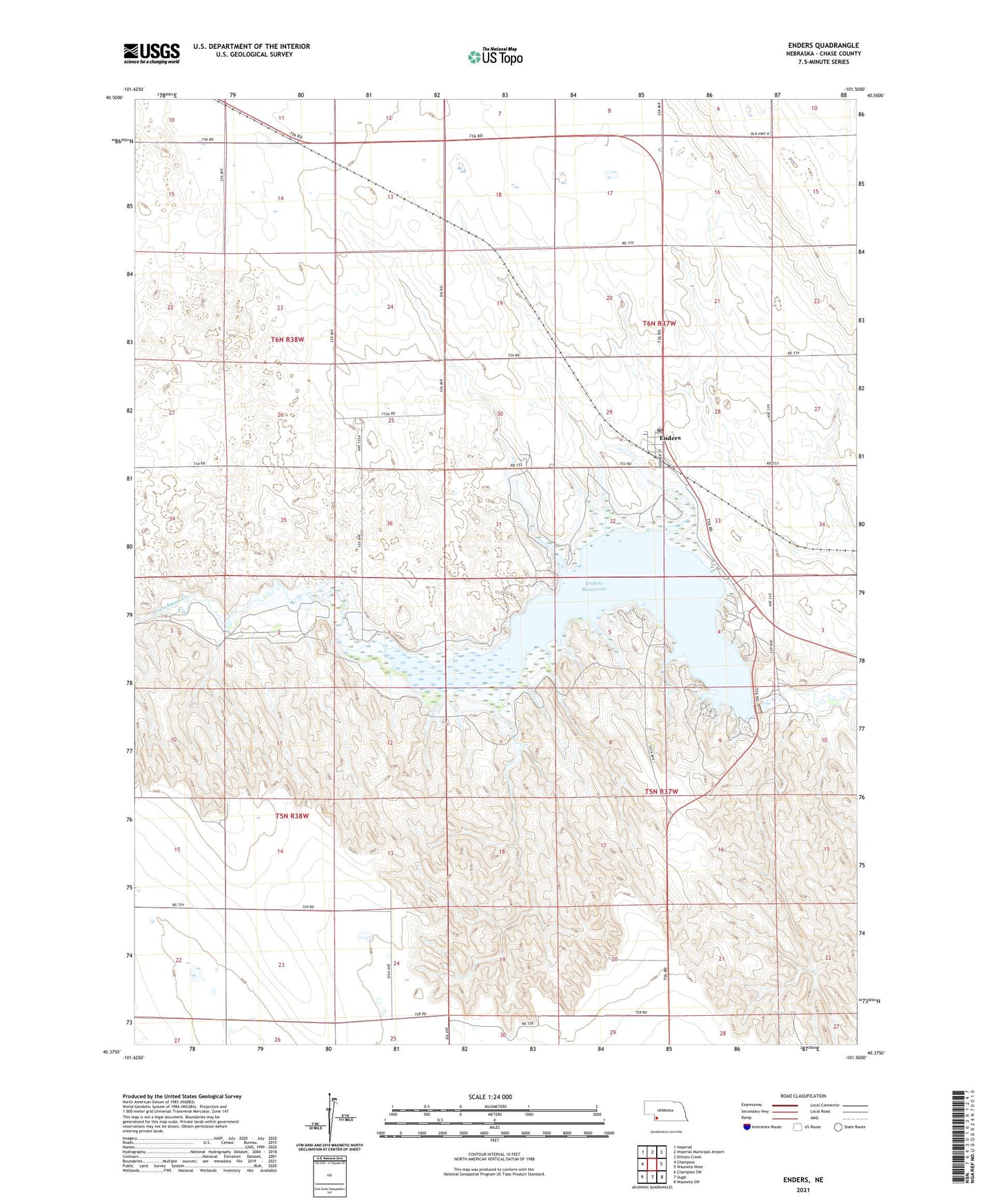
2021 topographic map quadrangle Enders in the state of Nebraska. Scale: 1:24000. Based on the newly updated USGS 7.5' US Topo map series, this map is in the following counties: Chase. The map contains contour data, water features, and other items you are used to seeing on USGS maps, but also has updated roads and other features. This is the next generation of topographic maps. Printed on high-quality waterproof paper with UV fade-resistant inks.
Quads adjacent to this one:
West: Champion
Northwest: Imperial
North: Imperial Municipal Airport
Northeast: Dittons Creek
East: Wauneta West
Southeast: Wauneta SW
South: Ough
Southwest: Champion SW
This map covers the same area as the classic USGS quad with code o40101d5.
Contains the following named places: Area A Campground, Center Dam Campground, Church Grove Recreation Area, Church of the Brethren, Enders, Enders Census Designated Place, Enders Dam, Enders Lake Golf Course, Enders Lake Golf Course RV Park, Enders Post Office, Enders Reservoir, Enders Reservoir State Recreation Area, Enders Reservoir State Wildlife Management Area, Pioneer Election Precinct, ZIP Code: 69027