MyTopo
Fairfield SE Nebraska US Topo Map
Couldn't load pickup availability
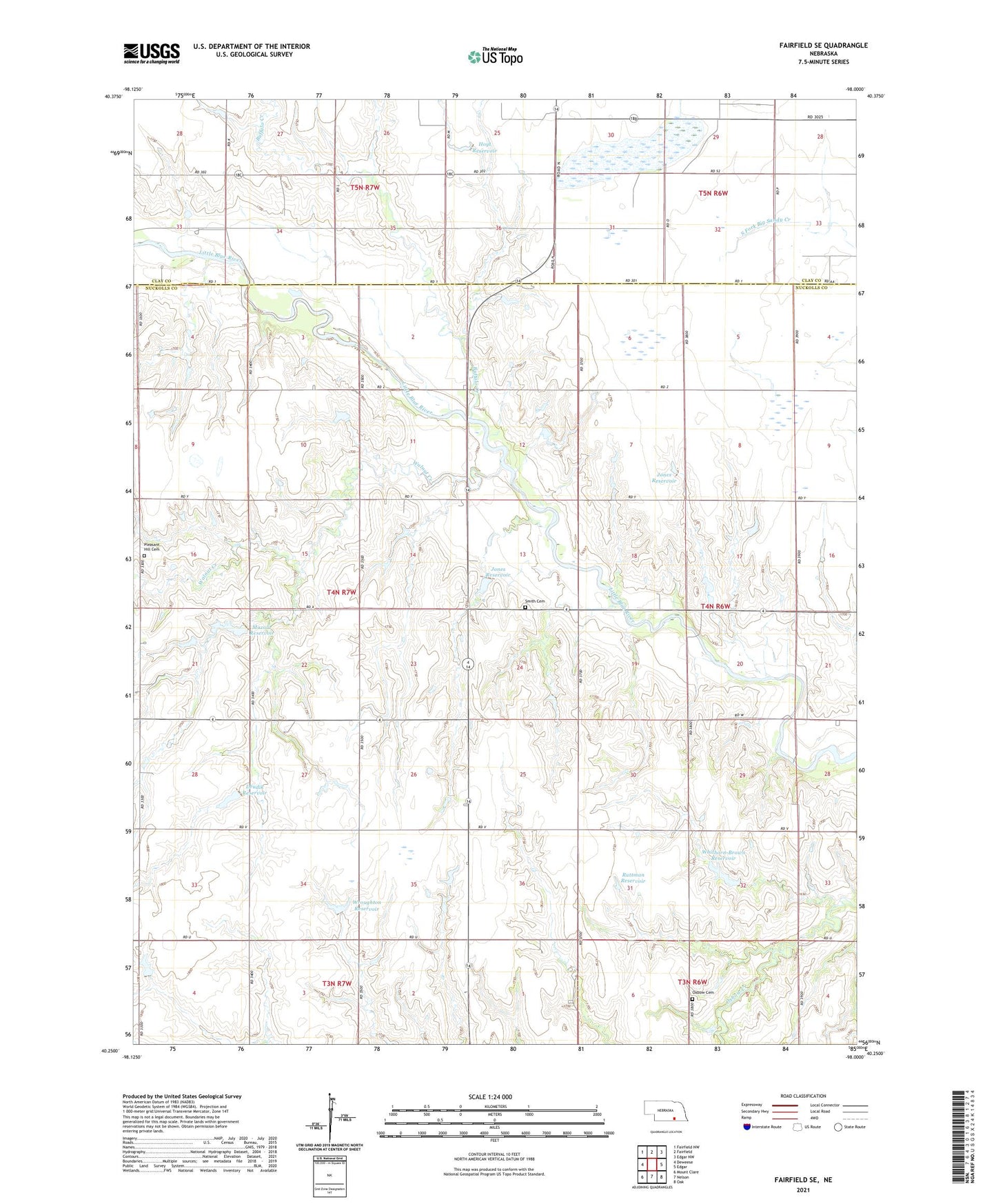
2021 topographic map quadrangle Fairfield SE in the state of Nebraska. Scale: 1:24000. Based on the newly updated USGS 7.5' US Topo map series, this map is in the following counties: Nuckolls, Clay. The map contains contour data, water features, and other items you are used to seeing on USGS maps, but also has updated roads and other features. This is the next generation of topographic maps. Printed on high-quality waterproof paper with UV fade-resistant inks.
Quads adjacent to this one:
West: Deweese
Northwest: Fairfield NW
North: Fairfield
Northeast: Edgar NW
East: Edgar
Southeast: Oak
South: Nelson
Southwest: Mount Clare
Contains the following named places: Bethany School, Bluewing State Wildlife Management Area, Buffalo Creek, Drudik Dam, Drudik Reservoir, East Buffalo School, Edgar Historical Marker, Hoyt Dam, Hoyt Reservoir, Indian Raids Historical Marker, Jones Dam, Jones Reservoir, Liberty Election Precinct, Mazour Dam-1 Dam, Mazour Reservoir, Oxbow Cemetery, Oxbow School, Pleasant Hill Cemetery, Pleasant View School, Ruttman Dam, Ruttman Reservoir, Smartweed Marsh State Wildlife Management Area, Smartweed Marsh West State Wildlife Management Area, Smith Cemetery, Township of Liberty, Township of Nelson, Walnut Creek, Whithorn-Brown Dam, Whithorn-Brown Reservoir, Wroughton Dam, Wroughton Reservoir