MyTopo
Oak Nebraska US Topo Map
Couldn't load pickup availability
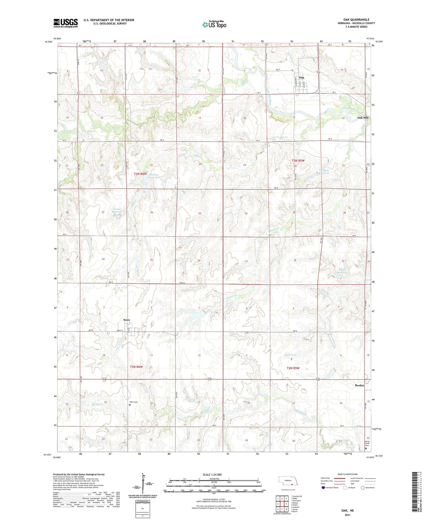
2021 topographic map quadrangle Oak in the state of Nebraska. Scale: 1:24000. Based on the newly updated USGS 7.5' US Topo map series, this map is in the following counties: Nuckolls. The map contains contour data, water features, and other items you are used to seeing on USGS maps, but also has updated roads and other features. This is the next generation of topographic maps. Printed on high-quality waterproof paper with UV fade-resistant inks.
Quads adjacent to this one:
West: Nelson
Northwest: Fairfield SE
North: Edgar
Northeast: Davenport
East: Ruskin
Southeast: Byron
South: Hardy
Southwest: Superior
This map covers the same area as the classic USGS quad with code o40097b8.
Contains the following named places: Bauman Dam, Bauman Reservoir, Biltoft Dam, Biltoft Reservoir, Blaine Election Precinct, Elk Creek, Farmers Union Cooperative Association Elevator, First Community Church, Frahm Dam, Frahm Reservoir, Heritage Room Museum, Indian Captives Historical Marker, Kings Daughters Library, Nora, Nora Cemetery, Nora Election Precinct, Nora Post Office, Nora United Methodist Church, Oak, Oak Creek, Oak Mill, Oak Post Office, Oak Volunteer Fire Department, Oregon Trail Park, Scroggin Dam, Scroggin Reservoir, Skirmish at Spring Creek Historical Marker, Spring Creek Cemetery, Spring Creek Election Precinct, Township of Blaine, Township of Elk, Township of Nora, Township of Spring Creek, Village of Nora, Village of Oak, Williams Dam, Williams Reservoir, ZIP Code: 68964