MyTopo
Deweese Nebraska US Topo Map
Couldn't load pickup availability
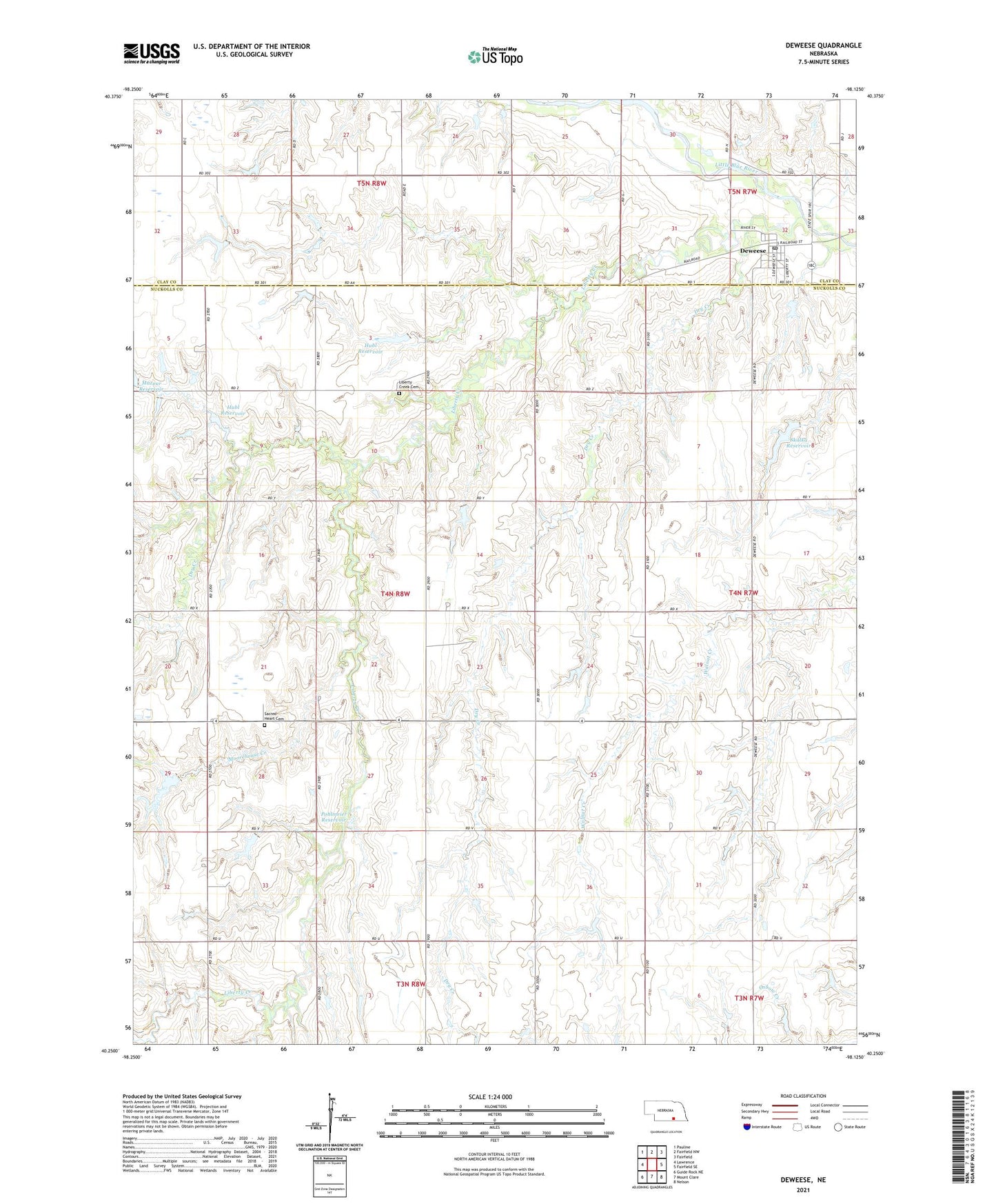
2021 topographic map quadrangle Deweese in the state of Nebraska. Scale: 1:24000. Based on the newly updated USGS 7.5' US Topo map series, this map is in the following counties: Nuckolls, Clay. The map contains contour data, water features, and other items you are used to seeing on USGS maps, but also has updated roads and other features. This is the next generation of topographic maps. Printed on high-quality waterproof paper with UV fade-resistant inks.
Quads adjacent to this one:
West: Lawrence
Northwest: Pauline
North: Fairfield NW
Northeast: Fairfield
East: Fairfield SE
Southeast: Nelson
South: Mount Clare
Southwest: Guide Rock NE
This map covers the same area as the classic USGS quad with code o40098c2.
Contains the following named places: Deweese, Deweese Post Office, Dry Creek, Hubl Dam-1 Dam, Hubl Dam-2 Dam, Hubl Dam-3 Dam, Hubl Reservoir, KUHG-FM (Hastings), Liberty Creek, Liberty Creek Cemetery, Liberty Farm, Liberty Farms Post Office, Mazour Dam, Moorehouse Creek, Pleasant Hill School, Pohlmeier Dam, Pohlmeier Reservoir, Roth School, Sacred Heart Cemetery, Saint Martin Church, Skalka Dam, Skalka Reservoir, Township of Saint Stephens, Township of Victor, Village of Deweese, ZIP Codes: 68934, 68957