MyTopo
Freedom Nebraska US Topo Map
Couldn't load pickup availability
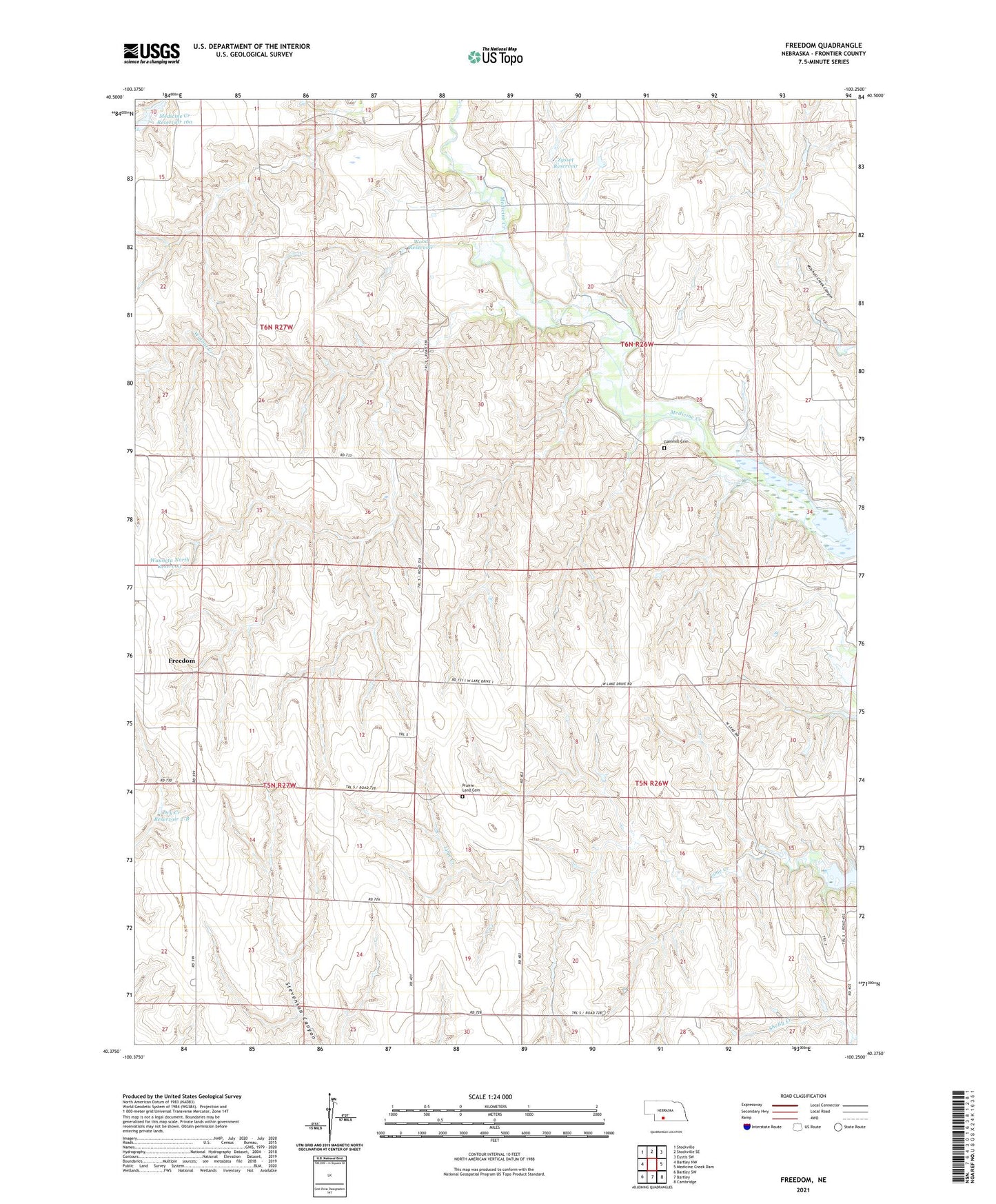
2021 topographic map quadrangle Freedom in the state of Nebraska. Scale: 1:24000. Based on the newly updated USGS 7.5' US Topo map series, this map is in the following counties: Frontier. The map contains contour data, water features, and other items you are used to seeing on USGS maps, but also has updated roads and other features. This is the next generation of topographic maps. Printed on high-quality waterproof paper with UV fade-resistant inks.
Quads adjacent to this one:
West: Bartley NW
Northwest: Stockville
North: Stockville SE
Northeast: Eustis SW
East: Medicine Creek Dam
Southeast: Cambridge
South: Bartley
Southwest: Bartley SW
Contains the following named places: Champion School, Cottonwood School, Dry Creek Dam 2-B, Dry Creek Reservoir 2-B, Freedom, Freedom Post Office, Gammill Cemetery, Garfield Election Precinct, Harry Strunk Lake, Lime Creek, Medicine Creek Dam 160, Medicine Creek Reservoir 160, Medicine Creek State Wildlife Management Area, Orafino Election Precinct, Prairie Land Cemetery, School Number 92, Township of Garfield, Township of Orafino, Walnut Creek, Wauneta North Dam, Wauneta North Reservoir, Wood Dam, Wood Reservoir, Zysset Dam, Zysset Reservoir