MyTopo
Stockville SE Nebraska US Topo Map
Couldn't load pickup availability
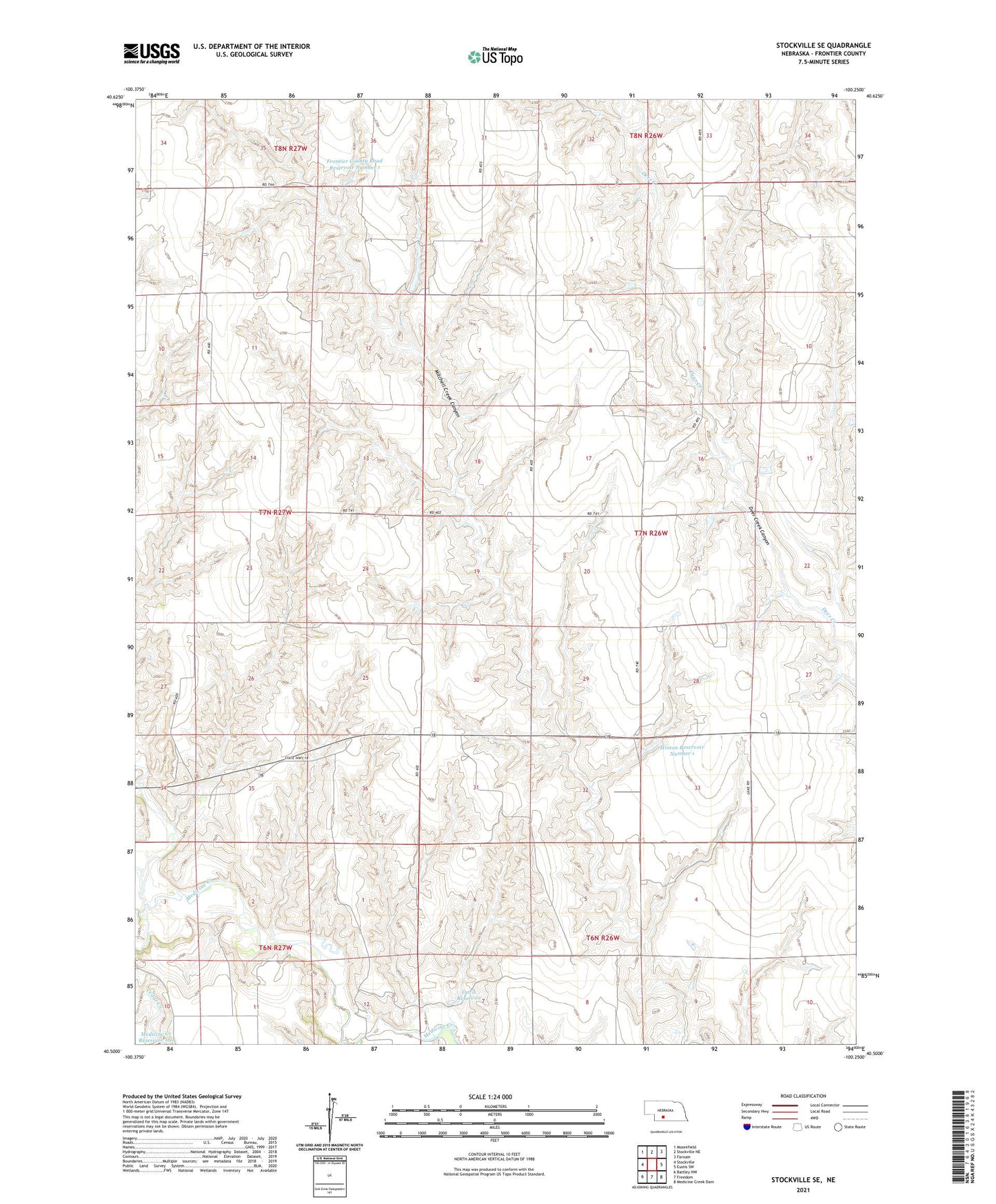
2021 topographic map quadrangle Stockville SE in the state of Nebraska. Scale: 1:24000. Based on the newly updated USGS 7.5' US Topo map series, this map is in the following counties: Frontier. The map contains contour data, water features, and other items you are used to seeing on USGS maps, but also has updated roads and other features. This is the next generation of topographic maps. Printed on high-quality waterproof paper with UV fade-resistant inks.
Quads adjacent to this one:
West: Stockville
Northwest: Moorefield
North: Stockville NE
Northeast: Farnam
East: Eustis SW
Southeast: Medicine Creek Dam
South: Freedom
Southwest: Bartley NW
This map covers the same area as the classic USGS quad with code o40100e3.
Contains the following named places: Bailey School, Boston Ridge School, Cedar Creek, Davis Dam, Davis Reservoir, Fairview School, Frontier County Road Dam Number 1, Frontier County Road Reservoir Number 1, Hilltop School, Hinton Dam, Hinton Reservoir Number 1, Horrell Election Precinct, Lynch School, Mount Pleasant School, Spring Creek, Township of Horrell