MyTopo
Garrison Nebraska US Topo Map
Couldn't load pickup availability
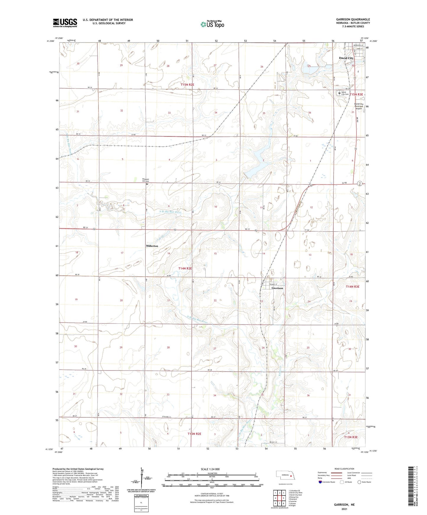
2021 topographic map quadrangle Garrison in the state of Nebraska. Scale: 1:24000. Based on the newly updated USGS 7.5' US Topo map series, this map is in the following counties: Butler. The map contains contour data, water features, and other items you are used to seeing on USGS maps, but also has updated roads and other features. This is the next generation of topographic maps. Printed on high-quality waterproof paper with UV fade-resistant inks.
Quads adjacent to this one:
West: Rising City
Northwest: Columbus SE
North: David City West
Northeast: David City East
East: Brainard
Southeast: Dwight
South: Ulysses
Southwest: Surprise
Contains the following named places: Aquinas High School, Bongers Sky Ranch Airfield, Butler County, David City Cemetery, David City Municipal Airport, David City Park, David City Park Campground, East Olive School, Garrison, Garrison Post Office, Garrison Public School, Garrison Volunteer Fire Department, Grass Valley Farms, Immanuel Church, Kezan Creek, Lincoln Park, Millerton, Millerton Post Office, Pleasant Hill Cemetery, Township of Union, Village of Garrison, West Olive School, Zion Church, ZIP Code: 68632