MyTopo
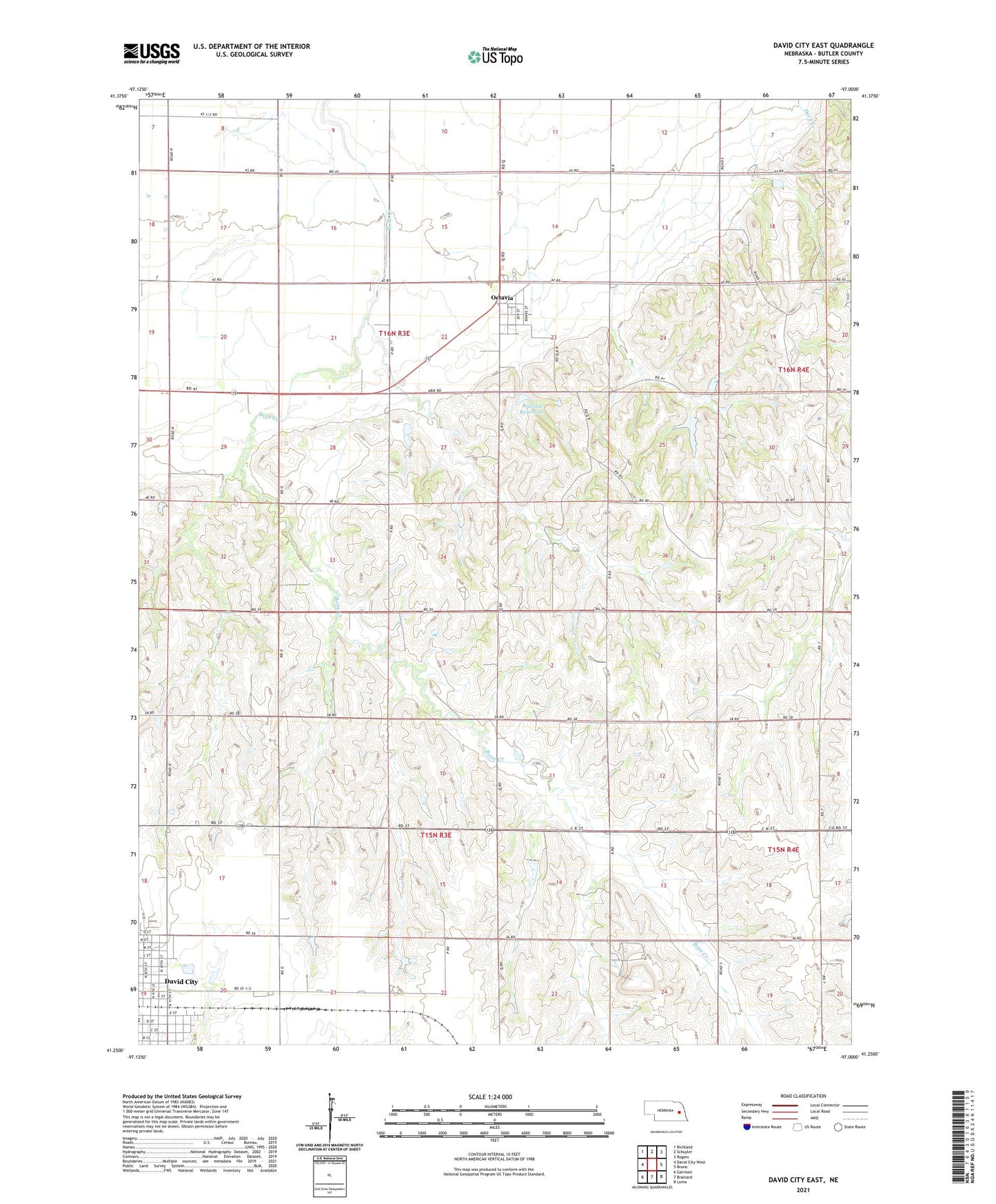
David City East Nebraska US Topo Map
Couldn't load pickup availability
2021 topographic map quadrangle David City East in the state of Nebraska. Scale: 1:24000. Based on the newly updated USGS 7.5' US Topo map series, this map is in the following counties: Butler. The map contains contour data, water features, and other items you are used to seeing on USGS maps, but also has updated roads and other features. This is the next generation of topographic maps. Printed on high-quality waterproof paper with UV fade-resistant inks.
Quads adjacent to this one:
West: David City West
Northwest: Richland
North: Schuyler
Northeast: Rogers
East: Bruno
Southeast: Loma
South: Brainard
Southwest: Garrison
This map covers the same area as the classic USGS quad with code o41097c1.
Contains the following named places: Appleton Post Office, Appleton School, Assumption Church, Brezina Dam, Brezina Reservoir, Butler County Landfill, David City Elementary School, Octavia, Octavia Community Church, Octavia Post Office, Redeemer Lutheran Church, Township of Bone Creek, Township of Franklin, Village of Octavia