MyTopo
Dwight Nebraska US Topo Map
Couldn't load pickup availability
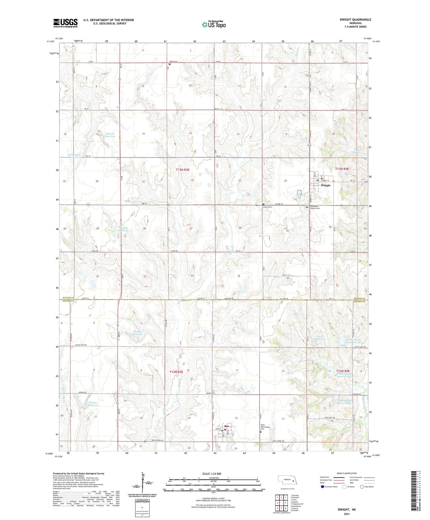
2021 topographic map quadrangle Dwight in the state of Nebraska. Scale: 1:24000. Based on the newly updated USGS 7.5' US Topo map series, this map is in the following counties: Butler, Seward. The map contains contour data, water features, and other items you are used to seeing on USGS maps, but also has updated roads and other features. This is the next generation of topographic maps. Printed on high-quality waterproof paper with UV fade-resistant inks.
Quads adjacent to this one:
West: Ulysses
Northwest: Garrison
North: Brainard
Northeast: Loma
East: Valparaiso SW
Southeast: Garland
South: Seward
Southwest: Staplehurst
This map covers the same area as the classic USGS quad with code o41097a1.
Contains the following named places: Assumption Catholic Cemetery, Assumption Church, Bee, Bee Post Office, Bee Public School, Bee Volunteer Fire Department, Blue Valley Cooperative Elevator, Detention Dam 82-B, Detention Dam 86-A, Detention Dam 87-A, Dwight, Dwight Community Library, Dwight Elementary School, Dwight Post Office, Dwight Volunteer Fire Department, Election Precinct B, Oak Middle Reservoir 87-A, Oak-Middle Reservoir 82-B, Oak-Middle Reservoir 86-A, Pekarek Dam, Pekarek Reservoir, Pruss Dam, Pruss Reservoir, Saint Wenceslaus Catholic Church, Saint Wenceslaus Cemetery, Skolnik Dam, Skolnik Dams Dam, Skolnik Reservoir, Stastny Dam, Stastny Reservoir, Township B, Township of Plum Creek, Union Cemetery, United Methodist Church, Vandenberg Dam, Vandenberg Reservoir, Village of Bee, Village of Dwight, Ware Cemetery, ZIP Codes: 68314, 68635