MyTopo
Gibbon North Nebraska US Topo Map
Couldn't load pickup availability
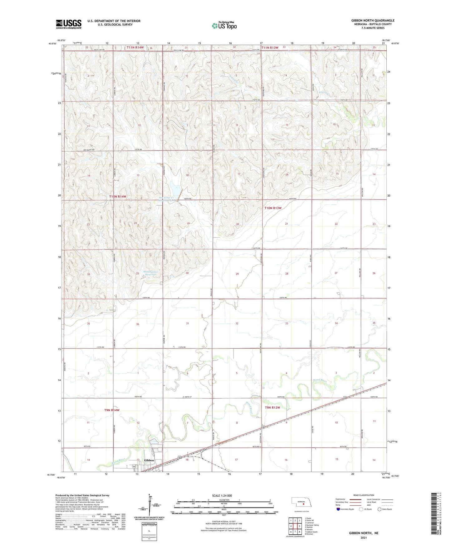
2021 topographic map quadrangle Gibbon North in the state of Nebraska. Scale: 1:24000. Based on the newly updated USGS 7.5' US Topo map series, this map is in the following counties: Buffalo. The map contains contour data, water features, and other items you are used to seeing on USGS maps, but also has updated roads and other features. This is the next generation of topographic maps. Printed on high-quality waterproof paper with UV fade-resistant inks.
Quads adjacent to this one:
West: Buckeye Valley
Northwest: Poole
North: Poole NE
Northeast: Cameron
East: Shelton
Southeast: Denman
South: Gibbon South
Southwest: Newark
Contains the following named places: Box Elder Creek Dam 5-A, Box Elder Creek Reservoir 5-A, Davis Park, Election Precinct 24, Gibbon Junction, Gibbon Valley View Golf Club, Glad Tidings Assembly of God Church, KKPR-FM (Kearney), Rhoadarmer Dam, Rhoadarmer Reservoir, Riverside School, School Number 17, School Number 18, School Number 30, School Number 5, School Number 56, Township of Sharon, ZIP Code: 68876