MyTopo
Gibbon South Nebraska US Topo Map
Couldn't load pickup availability
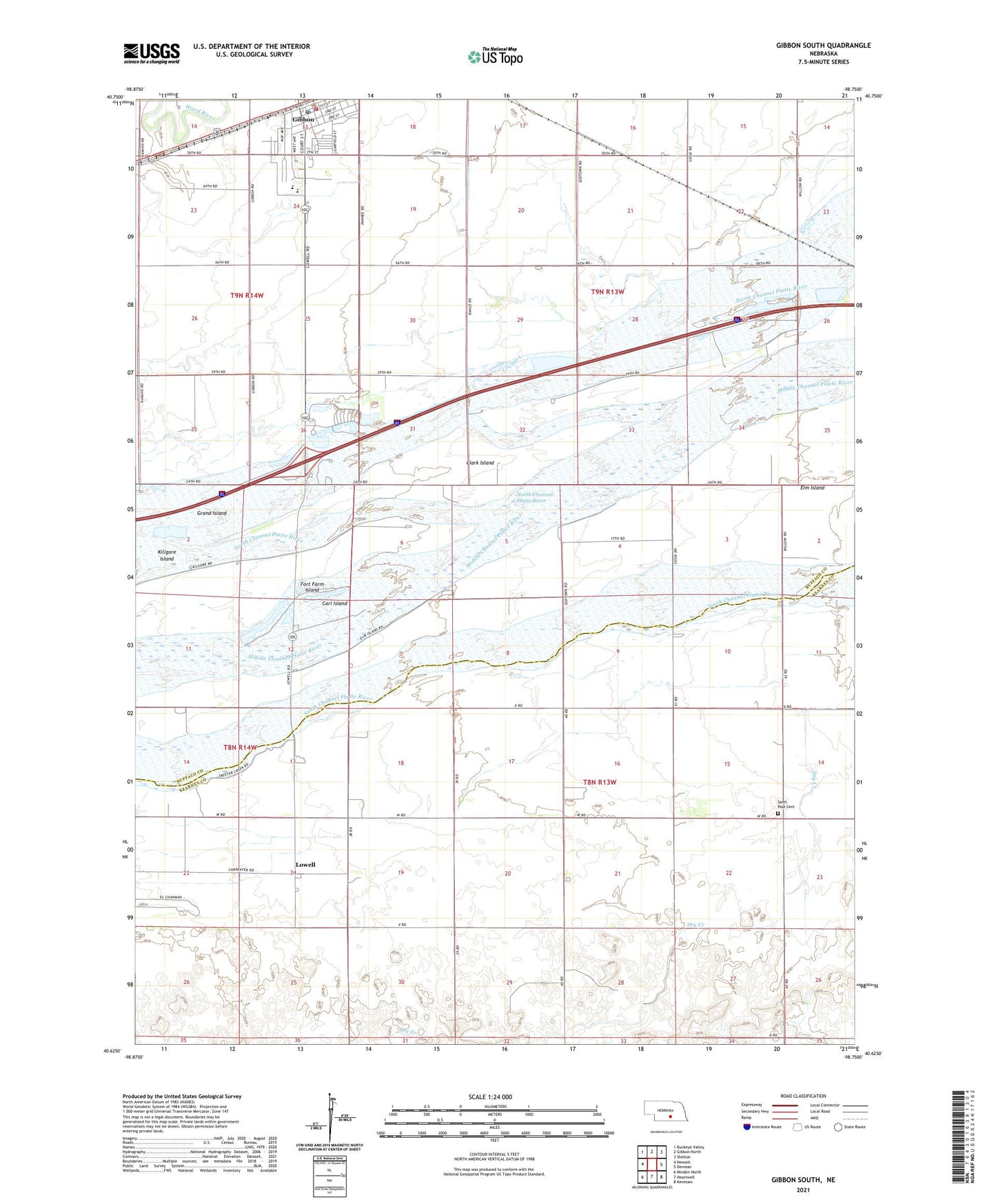
2021 topographic map quadrangle Gibbon South in the state of Nebraska. Scale: 1:24000. Based on the newly updated USGS 7.5' US Topo map series, this map is in the following counties: Buffalo, Kearney. The map contains contour data, water features, and other items you are used to seeing on USGS maps, but also has updated roads and other features. This is the next generation of topographic maps. Printed on high-quality waterproof paper with UV fade-resistant inks.
Quads adjacent to this one:
West: Newark
Northwest: Buckeye Valley
North: Gibbon North
Northeast: Shelton
East: Denman
Southeast: Kenesaw
South: Heartwell
Southwest: Minden North
This map covers the same area as the classic USGS quad with code o40098f7.
Contains the following named places: Bethel United Methodist Church, Cargill Incorporated Elevator, Carl Island, City of Gibbon, Clark Island, Election Precinct 22, Election Precinct 23, Elm Island, Faith United Church, Gibbon, Gibbon Baptist Church, Gibbon Dental Clinic, Gibbon Good Samaritan Center, Gibbon Historical Marker, Gibbon Police Department, Gibbon Post Office, Gibbon Public Library, Gibbon Public Schools, Gibbon Volunteer Fire Department, Grand Island, Kearney Station, KHGI-TV (Kearney), KQKY-FM (Kearney), L and J Mobile Home Court, Lowell, Lowell Historical Marker, Lowell Post Office, Nebraska Centre - Boyd Ranch Historical Marker, Saint Paul Cemetery, Saint Paul Church, School Number 22, School Number 42, Shanan Christian School, Sun Valley Trailer Court, Township of Lowell, Township of Platte, Township of Shelton, Valley City, Valley City Post Office, Windmill State Recreation Area, Windmill State Wildlife Management Area