MyTopo
Greenwood Nebraska US Topo Map
Couldn't load pickup availability
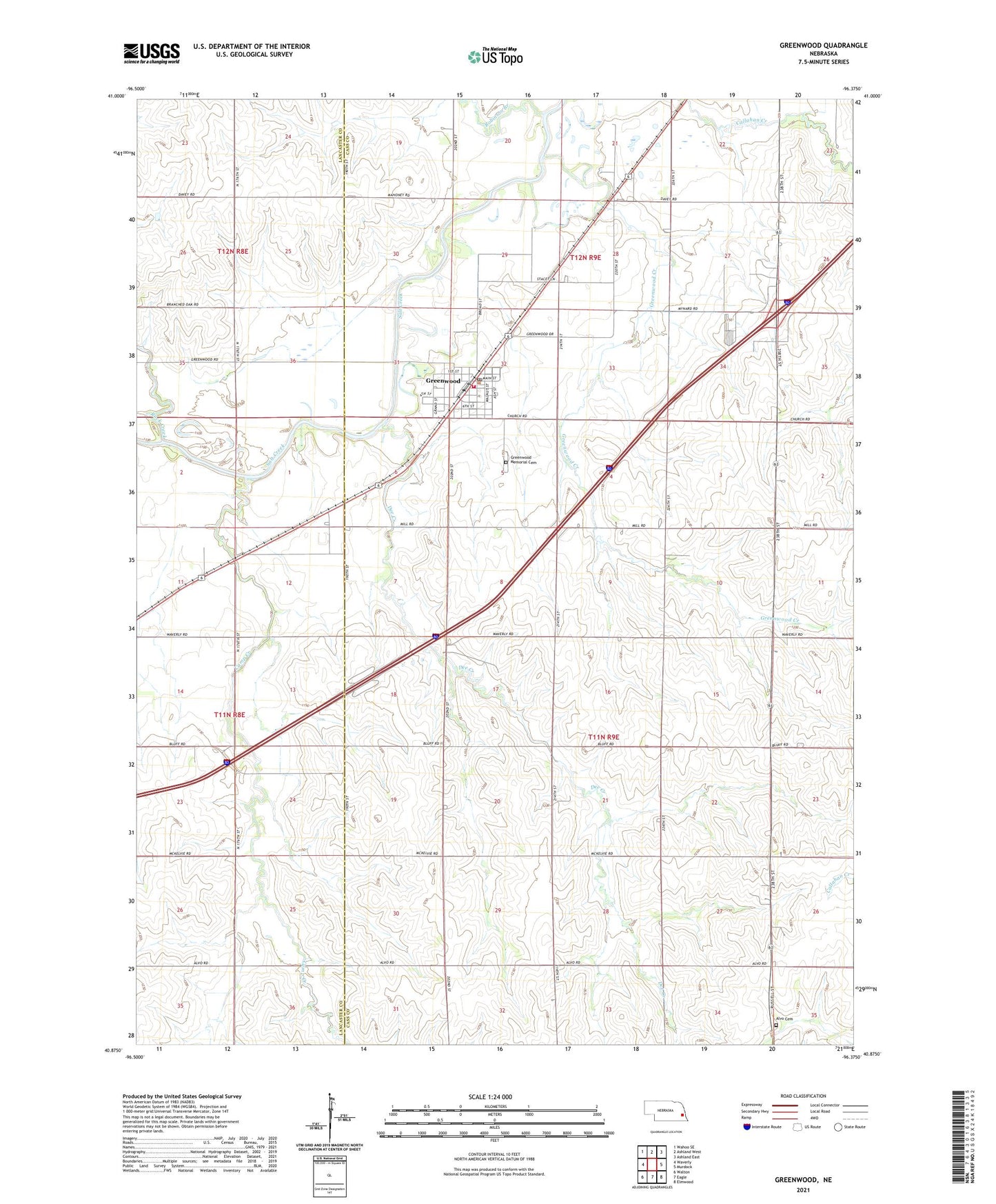
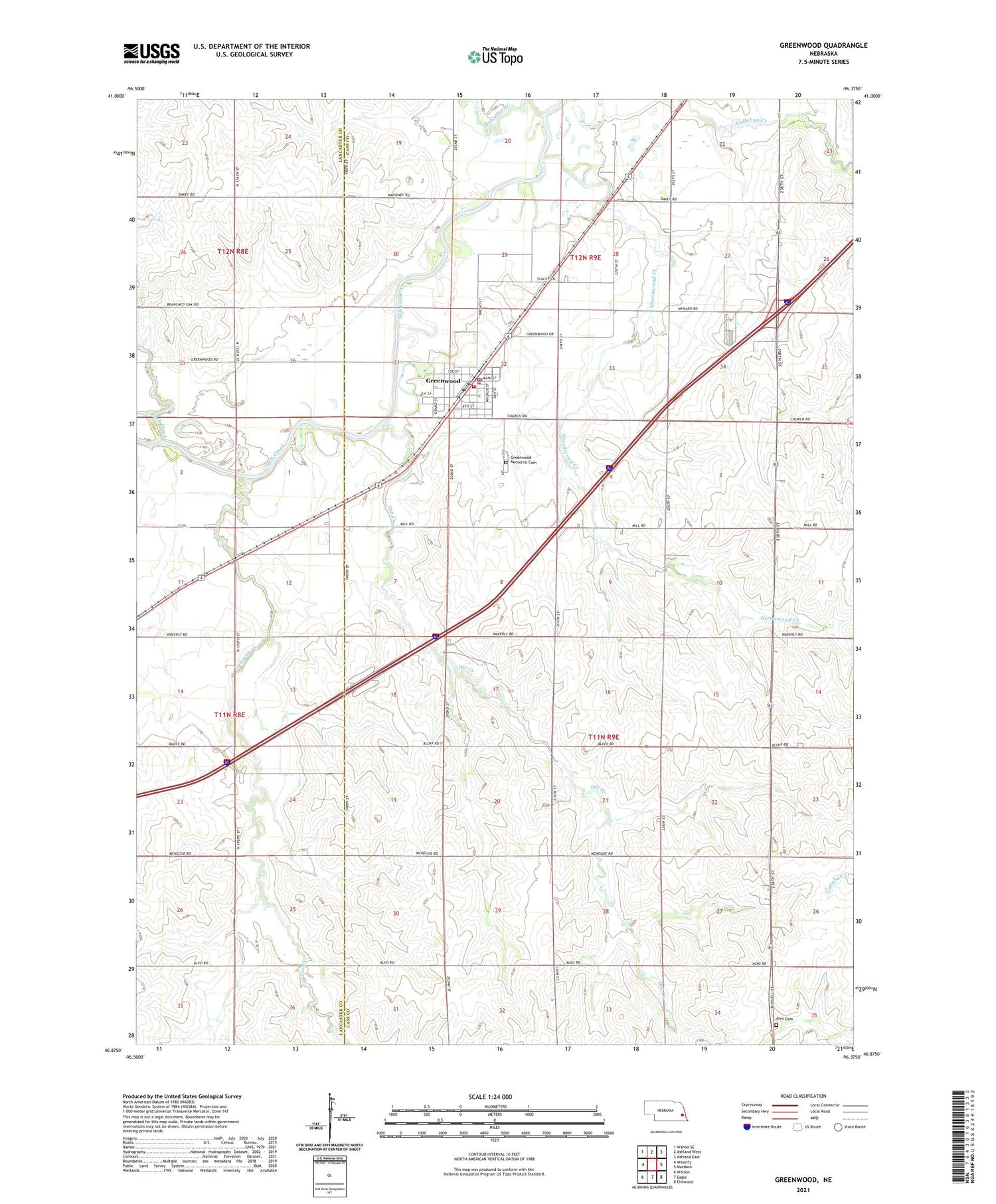
2021 topographic map quadrangle Greenwood in the state of Nebraska. Scale: 1:24000. Based on the newly updated USGS 7.5' US Topo map series, this map is in the following counties: Cass, Lancaster. The map contains contour data, water features, and other items you are used to seeing on USGS maps, but also has updated roads and other features. This is the next generation of topographic maps. Printed on high-quality waterproof paper with UV fade-resistant inks.
Quads adjacent to this one:
West: Waverly
Northwest: Wahoo SE
North: Ashland West
Northeast: Ashland East
East: Murdock
Southeast: Elmwood
South: Eagle
Southwest: Walton
Contains the following named places: Alvo Cemetery, Camp Creek, Dee Creek, Greenwood, Greenwood Christian Church, Greenwood Creek, Greenwood Depot Museum, Greenwood Election Precinct, Greenwood Farmers Cooperative Elevator, Greenwood Memorial Cemetery, Greenwood Post Office, Greenwood Public Library, Greenwood School, Greenwood United Methodist Church, Greenwood Volunteer Fire Department, Greenwood Volunteer Rescue Squad, I-80 Speedway, Pine Grove Holiday Trav-L-Park, Robinson Branch, Rock Creek, Saint Joseph Catholic Church, Salt Creek Election Precinct, School Number 81, Township of Greenwood, Township of Salt Creek, Village of Greenwood, ZIP Codes: 68304, 68366