MyTopo
Ashland East Nebraska US Topo Map
Couldn't load pickup availability
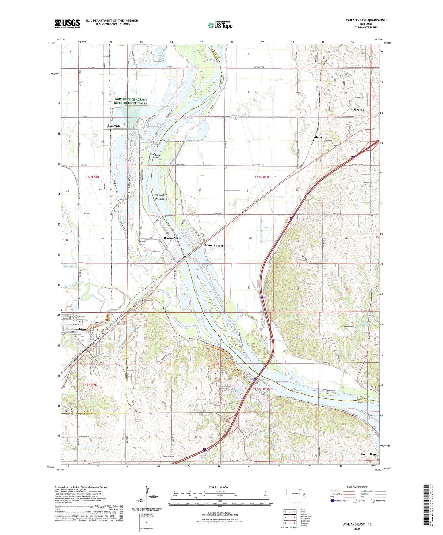
2021 topographic map quadrangle Ashland East in the state of Nebraska. Scale: 1:24000. Based on the newly updated USGS 7.5' US Topo map series, this map is in the following counties: Sarpy, Saunders, Cass. The map contains contour data, water features, and other items you are used to seeing on USGS maps, but also has updated roads and other features. This is the next generation of topographic maps. Printed on high-quality waterproof paper with UV fade-resistant inks.
Quads adjacent to this one:
West: Ashland West
Northwest: Mead
North: Wann
Northeast: Gretna
East: Springfield
Southeast: Manley
South: Murdock
Southwest: Greenwood
This map covers the same area as the classic USGS quad with code o41096a3.
Contains the following named places: Abel, Ak-Sar-Ben Aquarium, Armbrust Dam, Ashland, Ashland - Greenwood Elementary School, Ashland - Greenwood High School, Ashland Dental Clinic, Ashland Grain Elevator, Ashland Post Office, Ashland Public Library, Beacon View, Beacon View Census Designated Place, Big Sandy Lake, Christian Church, City of Ashland, Clear Creek, Comgregational Church, Community Care of America, E T Mahoney Trails, Elkhorn River, Eugene T Mahoney State Park, Forest City Number 2 Election Precinct, Great Platte Valley Historical Marker, Gretna Fish Hatchery Historical Marker, Gretna Fish Hatchery Museum, HJ Paul Army Heliport, Iron Horse, Iron Horse Golf Club, Kingdom Hall of Jehovahs Witnesses, Knoll Chiropractic Clinic, Lakeside Campground, Lincoln Family Medical Group, Linoma Beach, Linoma Beach Campground, Linoma Beach Census Designated Place, Little Creek Campground, Melia, Melia Census Designated Place, Melia Hill Rest Area, Melia Post Office, Melia-Forest City Election Precinct, Memorial to the American Bandshell Sculpture, Nebraska Crossing, NebraSKI Area Complex, Ox-Bow Trail Historical Marker, Pawnee Creek, Philpot Dam, Philpot Reservoir, Platte River Rest Area, Prehistorical Burial Site Historical Marker, Quarry Oaks Golf Course, Riverside, Saint Marys Church, Salt Creek, School Number 58, Schramm Park National Recreation Trail, Schramm Park State Recreational Area, South Bend School, Strategic Air Command Museum, Thousand Oaks Lake, United Methodist Church, US West Lake, Wahoo Creek, West Omaha KOA, Western Sarpy Ditch, Wilburn Island, Wildlife Safari, Wortman Cemetery, ZIP Code: 68028