MyTopo
Guide Rock Nebraska US Topo Map
Couldn't load pickup availability
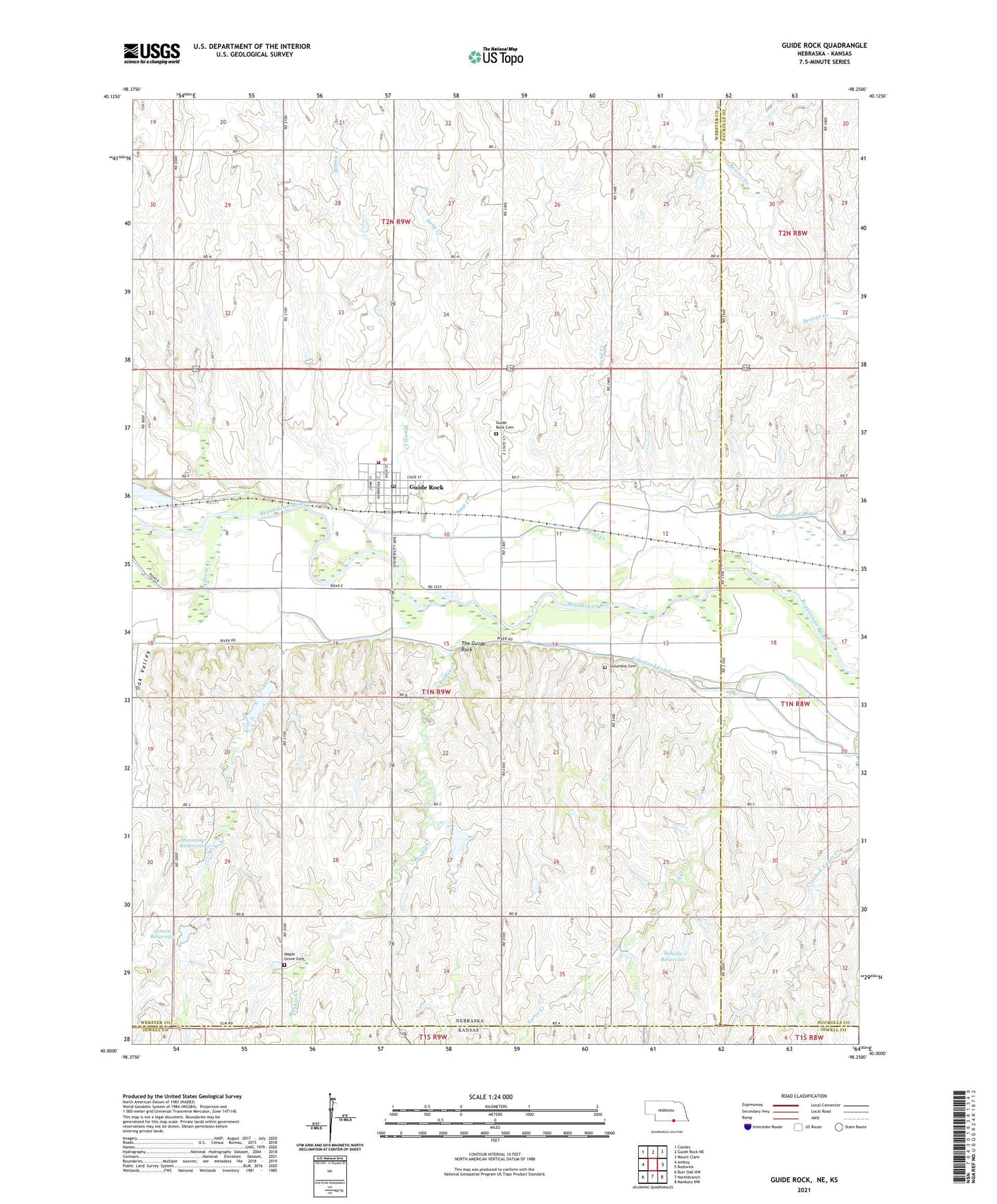
2021 topographic map quadrangle Guide Rock in the state of Nebraska. Scale: 1:24000. Based on the newly updated USGS 7.5' US Topo map series, this map is in the following counties: Webster, Nuckolls, Jewell. The map contains contour data, water features, and other items you are used to seeing on USGS maps, but also has updated roads and other features. This is the next generation of topographic maps. Printed on high-quality waterproof paper with UV fade-resistant inks.
Quads adjacent to this one:
West: Amboy
Northwest: Cowles
North: Guide Rock NE
Northeast: Mount Clare
East: Bostwick
Southeast: Mankato NW
South: Northbranch
Southwest: Burr Oak NW
Contains the following named places: Advent Creek, Auld-Doudna Public Library, Columbia Cemetery, Courtland Canal, Crooked Anger Creek, Ely Airport, Elys Incorporated Elevator, Farmers Union Cooperative Company Elevator, Guide Rock, Guide Rock Cemetery, Guide Rock Medical Clinic, Guide Rock Post Office, Guide Rock Public Schools, Guide Rock Volunteer Fire and Rescue, Jensen Dam, Jensen Reservoir, Johnston Dam, Johnston Reservoir, Maple Grove Cemetery, Minnie Creek, Oak Valley, Ohmstede Dam, Ohmstede Dam-1 Dam, Ohmstede Reservoir, Pawnee Lake, Rankin Creek, Republican Pawnee Village Historical Marker, Republican Valley Wayside Park, Sand Creek, Scholtz Dam, Scholtz Reservoir, Soap Creek, The Guide Rock, Village of Guide Rock, Willow Creek, ZIP Code: 68942