MyTopo
Cowles Nebraska US Topo Map
Couldn't load pickup availability
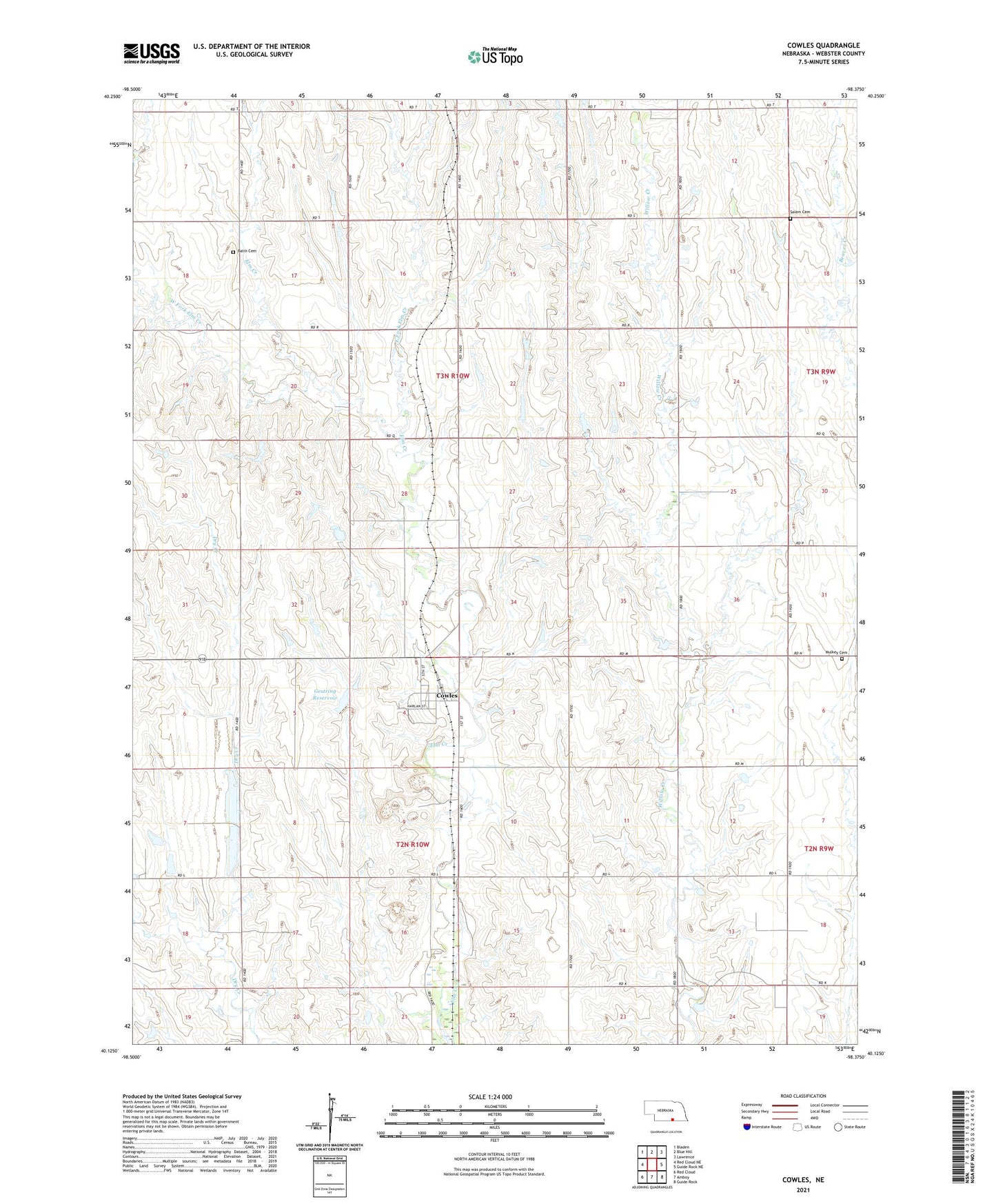
2021 topographic map quadrangle Cowles in the state of Nebraska. Scale: 1:24000. Based on the newly updated USGS 7.5' US Topo map series, this map is in the following counties: Webster. The map contains contour data, water features, and other items you are used to seeing on USGS maps, but also has updated roads and other features. This is the next generation of topographic maps. Printed on high-quality waterproof paper with UV fade-resistant inks.
Quads adjacent to this one:
West: Red Cloud NE
Northwest: Bladen
North: Blue Hill
Northeast: Lawrence
East: Guide Rock NE
Southeast: Guide Rock
South: Amboy
Southwest: Red Cloud
This map covers the same area as the classic USGS quad with code o40098b4.
Contains the following named places: Batin Cemetery, Cowles, Cowles Post Office, East Fork Elm Creek, Election District 1, Gestring Dam, Gestring Reservoir, Mulkey Cemetery, Red Cloud-Cowles Election Precinct, Salem Cemetery, Village of Cowles, Webster County, West Fork Elm Creek