MyTopo
Hemingford Nebraska US Topo Map
Couldn't load pickup availability
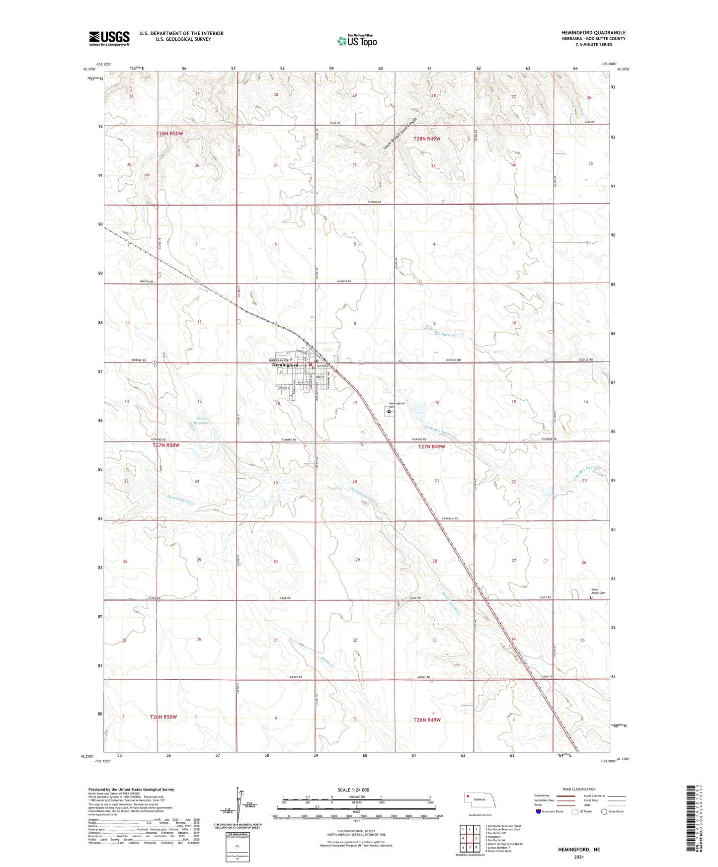
2021 topographic map quadrangle Hemingford in the state of Nebraska. Scale: 1:24000. Based on the newly updated USGS 7.5' US Topo map series, this map is in the following counties: Box Butte. The map contains contour data, water features, and other items you are used to seeing on USGS maps, but also has updated roads and other features. This is the next generation of topographic maps. Printed on high-quality waterproof paper with UV fade-resistant inks.
Quads adjacent to this one:
West: Nonpareil
Northwest: Box Butte Reservoir West
North: Box Butte Reservoir East
Northeast: Box Butte NW
East: Box Butte SW
Southeast: Berea Creek West
South: School Number 7
Southwest: Barrel Springs Creek North
This map covers the same area as the classic USGS quad with code o42103c1.
Contains the following named places: Box Butte County Fairgrounds, Congregational Church, Dorsey Election Precinct, Farmers Co-op Elevator Company Elevator, Fisher Dam, Fisher Reservoir, Hemingford, Hemingford Cemetery, Hemingford City Park, Hemingford Clinic, Hemingford Community Care Center, Hemingford Elementary School, Hemingford High School, Hemingford Historical Marker, Hemingford Police Department, Hemingford Post Office, Hemingford Public Library, Hemingford Volunteer Fire Department, Nazarene Church, Saint Bridget Catholic Church, Saint Johns Cemetery, School Number 49, Seventh Day Adventist Church, United Methodist Church, Village of Hemingford