MyTopo
Herman Nebraska US Topo Map
Couldn't load pickup availability
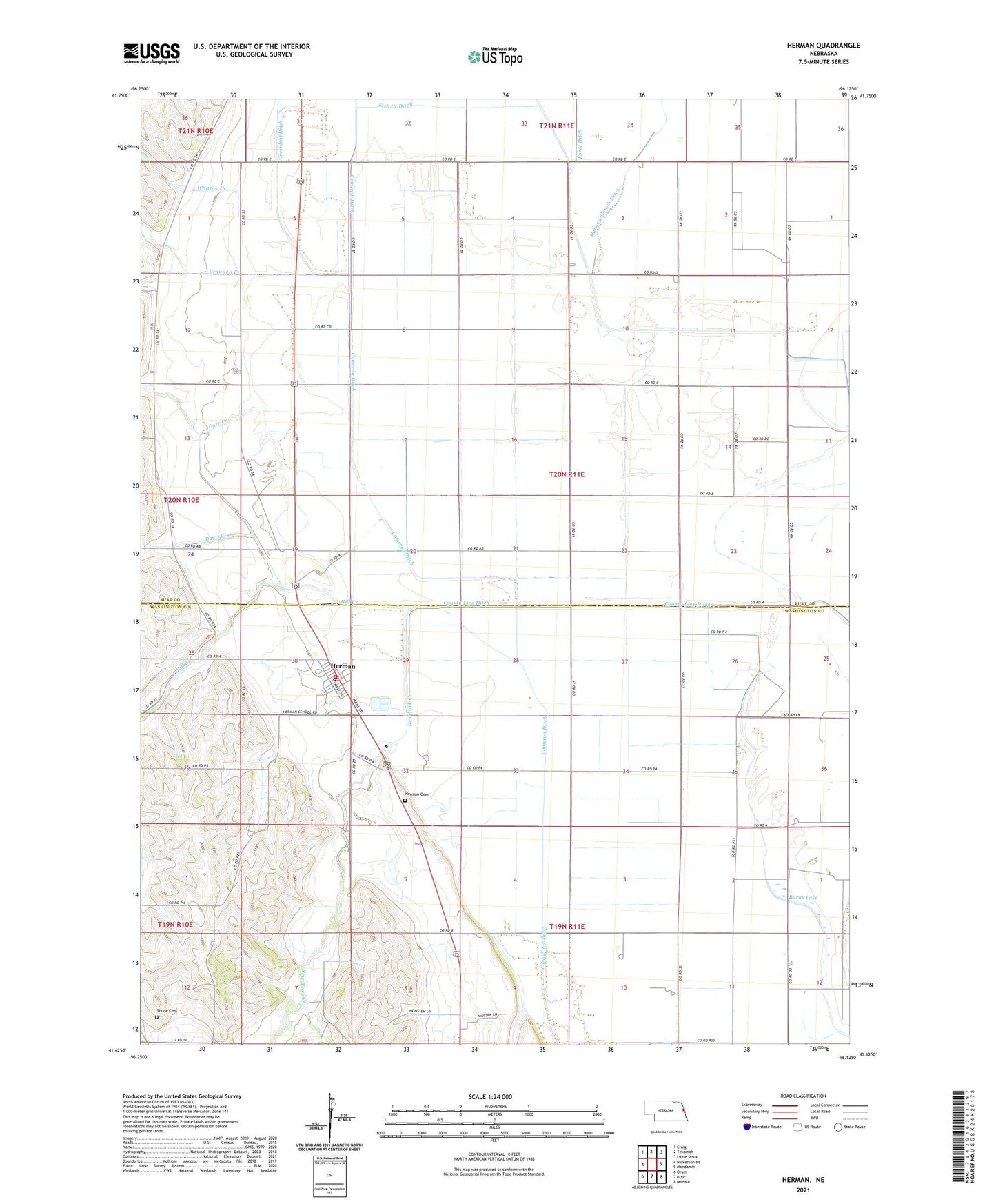
2021 topographic map quadrangle Herman in the state of Nebraska. Scale: 1:24000. Based on the newly updated USGS 7.5' US Topo map series, this map is in the following counties: Burt, Washington. The map contains contour data, water features, and other items you are used to seeing on USGS maps, but also has updated roads and other features. This is the next generation of topographic maps. Printed on high-quality waterproof paper with UV fade-resistant inks.
Quads adjacent to this one:
West: Nickerson NE
Northwest: Craig
North: Tekamah
Northeast: Little Sioux
East: Mondamin
Southeast: Modale
South: Blair
Southwest: Orum
Contains the following named places: Baptist Church, Burns Lake, Cameron Ditch, Carr Creek, County Line Ditch, Crannell Creek, Davis Creek, Harney Slough Ditch, Herman, Herman Cemetery, Herman Park, Herman Post Office, Herman Rescue Squad, Herman Volunteer Fire and Rescue, Hill Creek, Holmquist Grain and Lumber Company Elevator, New York Creek, Ranch Spur, Tekamah-Herman Grade School, Thone Cemetery, Township of Cuming City, Tysons Incorporated Elevator, United Methodist Church, Village of Herman, Whittier Creek