MyTopo
Little Sioux Iowa US Topo Map
Couldn't load pickup availability
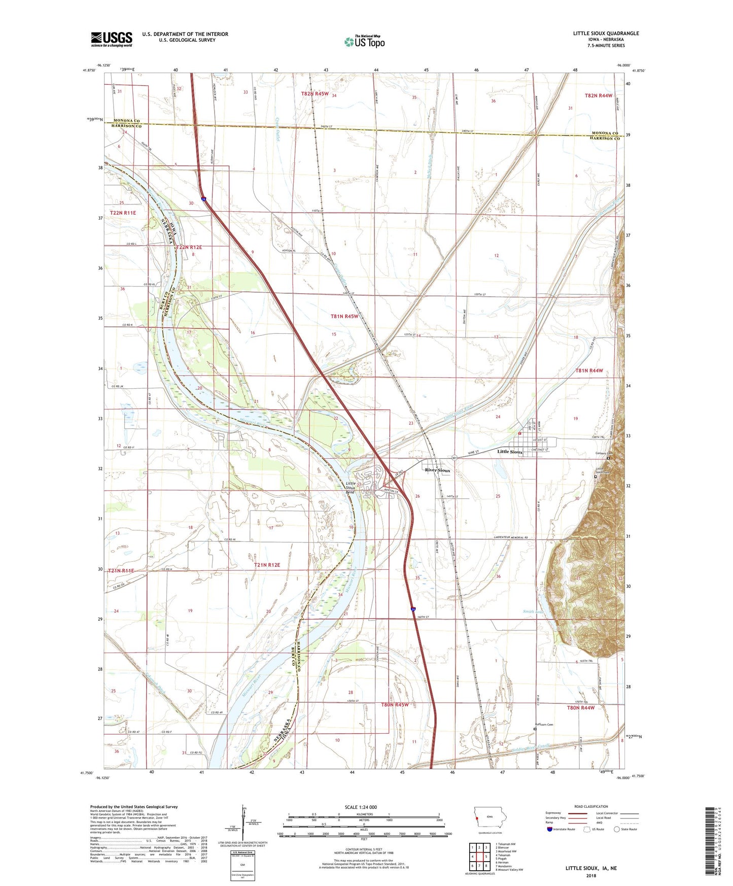
2022 topographic map quadrangle Little Sioux in the states of Iowa, Nebraska. Scale: 1:24000. Based on the newly updated USGS 7.5' US Topo map series, this map is in the following counties: Harrison, Burt, Monona. The map contains contour data, water features, and other items you are used to seeing on USGS maps, but also has updated roads and other features. This is the next generation of topographic maps. Printed on high-quality waterproof paper with UV fade-resistant inks.
Quads adjacent to this one:
West: Tekamah
Northwest: Tekamah NW
North: Blencoe
Northeast: Moorhead NW
East: Pisgah
Southeast: Missouri Valley NW
South: Mondamin
Southwest: Herman
Contains the following named places: City of Little Sioux, Conyers Cemetery, Crane Outlet, Deer Island State Game Management Area, Little Sioux, Little Sioux Bend, Little Sioux Cemetery, Little Sioux Fire Department, Little Sioux Post Office, Little Sioux River, McNeil Ditch, Murray Hill Overlook, Pelican Point State Recreation Area, River Sioux, River Sioux Census Designated Place, River Sioux Post Office, River Sioux Station, Ruffcorn Cemetery, Smith Lake, Soldier River Cutoff, Tekamah Ditch, Three Rivers Wildlife Area, Township of Little Sioux, ZIP Code: 51545