MyTopo
Hildreth Nebraska US Topo Map
Couldn't load pickup availability
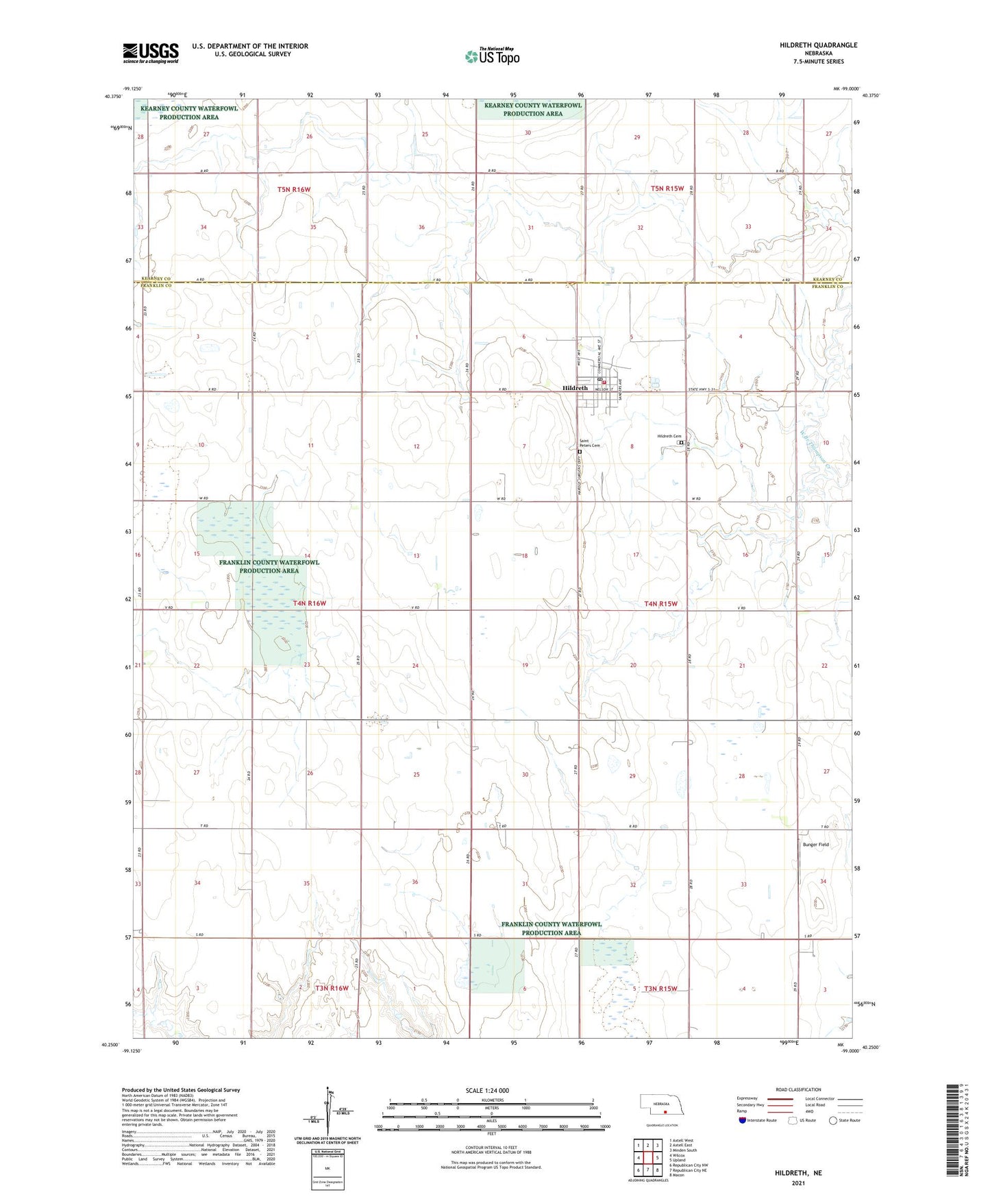
2021 topographic map quadrangle Hildreth in the state of Nebraska. Scale: 1:24000. Based on the newly updated USGS 7.5' US Topo map series, this map is in the following counties: Franklin, Kearney. The map contains contour data, water features, and other items you are used to seeing on USGS maps, but also has updated roads and other features. This is the next generation of topographic maps. Printed on high-quality waterproof paper with UV fade-resistant inks.
Quads adjacent to this one:
West: Wilcox
Northwest: Axtell West
North: Axtell East
Northeast: Minden South
East: Upland
Southeast: Macon
South: Republican City NE
Southwest: Republican City NW
Contains the following named places: Bunger Field, Emmanuel Church, Farmers Cooperative Grain Supply Company Elevator, Franklin County Memorial Hospital - Medical Clinic, Hildreth, Hildreth Cemetery, Hildreth Post Office, Hildreth Public Library, Hildreth Public Schools, Hildreth Volunteer Fire Department, Quadhamer Federal Waterfowl Production Area, Ritterbush Federal Waterfowl Production Area, Saint Pauls Evangelical Lutheran Church, Saint Peters Cemetery, Saint Peters Church, Township of Lincoln, Township of Salem, Village of Hildreth, ZIP Code: 68947