MyTopo
Humboldt Nebraska US Topo Map
Couldn't load pickup availability
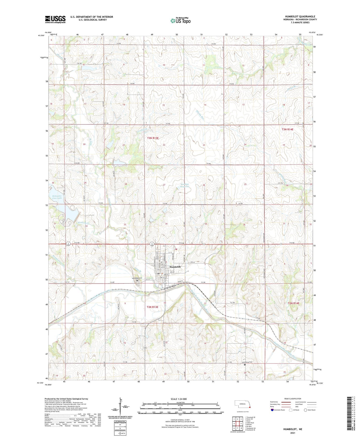
2021 topographic map quadrangle Humboldt in the state of Nebraska. Scale: 1:24000. Based on the newly updated USGS 7.5' US Topo map series, this map is in the following counties: Richardson. The map contains contour data, water features, and other items you are used to seeing on USGS maps, but also has updated roads and other features. This is the next generation of topographic maps. Printed on high-quality waterproof paper with UV fade-resistant inks.
Quads adjacent to this one:
West: Table Rock
Northwest: Tecumseh SE
North: Howe SW
Northeast: Howe
East: Dawson
Southeast: Humboldt SE
South: Humboldt SW
Southwest: Du Bois
Contains the following named places: Bruun Memorial Library, Christian Church, City of Humboldt, Colonial Acres Nursing Home, Community Memorial Hospital, Crooked Branch, Faith Lutheran Church, First Presbyterian Church, Franklin Election Precinct, Humboldt, Humboldt Bible Church, Humboldt Cemetery, Humboldt City Well, Humboldt Election Precinct, Humboldt Family Practice, Humboldt Grain and Flour Company Elevator, Humboldt Hospital Heliport, Humboldt Lake Park, Humboldt Lake Park Campground, Humboldt Police Department, Humboldt Post Office, Humboldt Public Schools, Humboldt Rescue, Humboldt Volunteer Fire Department, Kirkham Creek, Kirkmans Cove Lake, Kirkmans Cove Recreation Area, Kirkmans Cove Recreation Area Campground, Kirkmans Lakeview Gold Course, Lions Club Fountain, Long Branch, Long Branch Post Office, Lynchburg Cemetery, Monond Post Office, Parkside Dental Clinic, Pine Ridge School, Round Grove Creek, Saint James Lutheran Church, Town Square Park, Township of Franklin, Township of Humboldt, United Methodist Church, Wilhelm Grain Incorporated Elevator, Yearling Dam, Yearling Reservoir, ZIP Code: 68376