MyTopo
Indianola Nebraska US Topo Map
Couldn't load pickup availability
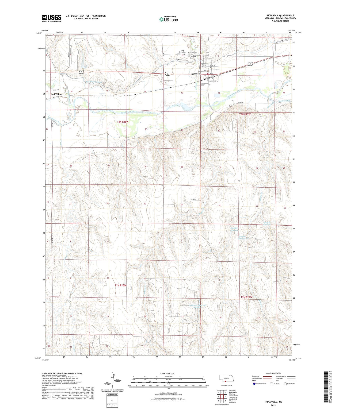
2021 topographic map quadrangle Indianola in the state of Nebraska. Scale: 1:24000. Based on the newly updated USGS 7.5' US Topo map series, this map is in the following counties: Red Willow. The map contains contour data, water features, and other items you are used to seeing on USGS maps, but also has updated roads and other features. This is the next generation of topographic maps. Printed on high-quality waterproof paper with UV fade-resistant inks.
Quads adjacent to this one:
West: McCook East
Northwest: Quick SE
North: Bartley SW
Northeast: Bartley
East: Danbury NE
Southeast: Lebanon
South: Danbury
Southwest: McCook SE
Contains the following named places: Ash Creek, Bondville Election Precinct, Buffalo Creek, Cedar Grove Cemetery, City of Indianola, Coon Creek, Indianola, Indianola Cemetery, Indianola City park, Indianola Medical Clinic, Indianola Post Office, Indianola Public Library, Indianola Volunteer Fire Department, Malleck Dam, Malleck Reservoir, Pawnee Womans Grave Historical Marker, Quigley Dam, Quigley Reservoir, Red Willow, Red Willow County, Red Willow Creek, Red Willow Election Precinct, Red Willow Post Office, Republican Valley School, Saint Catherine Cemetery, Saint Catherines Church, Schaffert Dam, Schaffert Reservoir, School Number 27, Sughrone Dam Number 2, Sughrone Reservoir Number 2, Township of Bondville, Township of Red Willow, United Methodist Church, Youngs Trailer Court