MyTopo
Danbury Nebraska US Topo Map
Couldn't load pickup availability
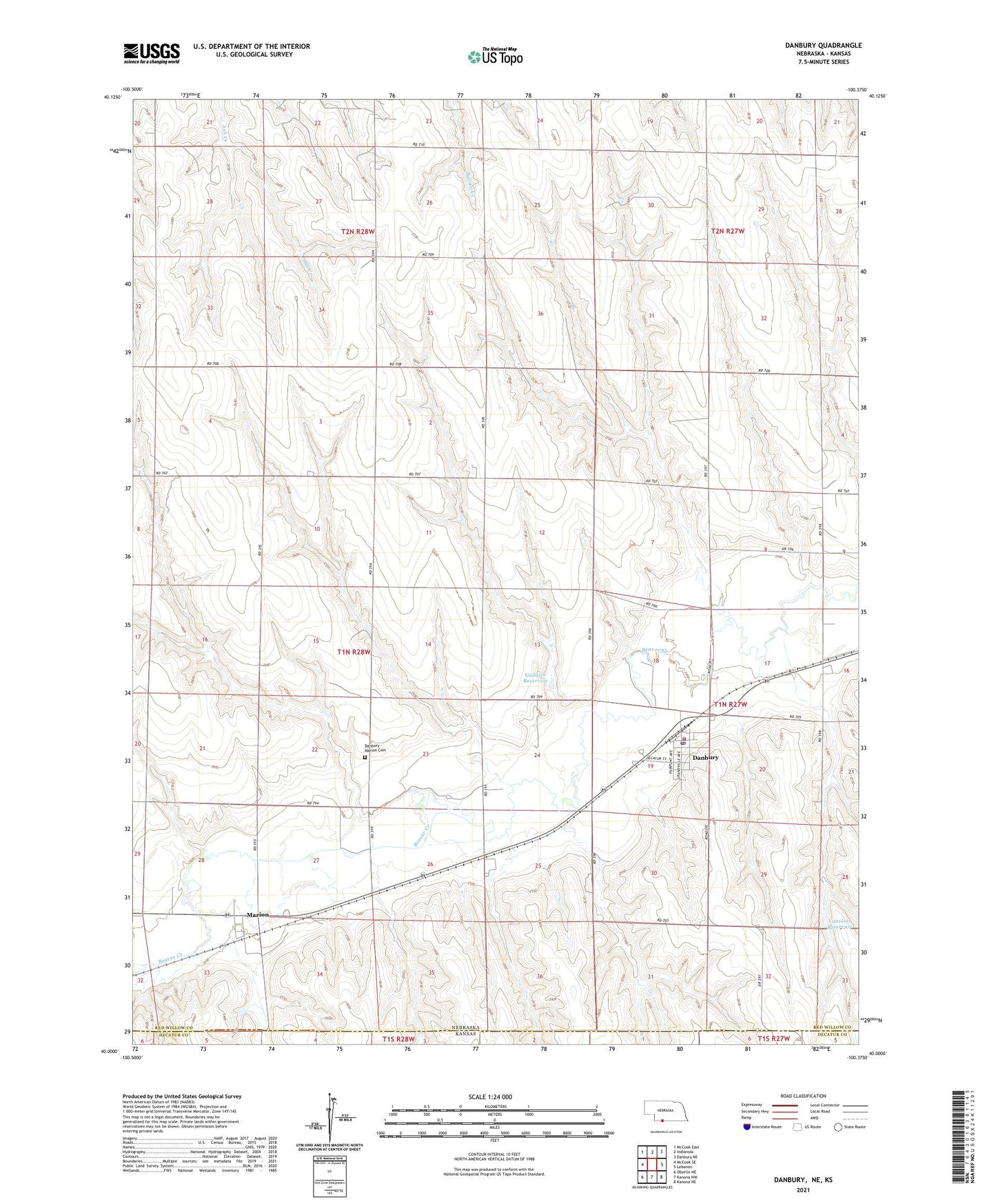
2021 topographic map quadrangle Danbury in the state of Nebraska. Scale: 1:24000. Based on the newly updated USGS 7.5' US Topo map series, this map is in the following counties: Red Willow, Decatur. The map contains contour data, water features, and other items you are used to seeing on USGS maps, but also has updated roads and other features. This is the next generation of topographic maps. Printed on high-quality waterproof paper with UV fade-resistant inks.
Quads adjacent to this one:
West: McCook SE
Northwest: McCook East
North: Indianola
Northeast: Danbury NE
East: Lebanon
Southeast: Kanona NE
South: Kanona NW
Southwest: Oberlin NE
This map covers the same area as the classic USGS quad with code o40100a4.
Contains the following named places: Beaver Valley Rural Fire District Danbury, Center Divide School, Danbury, Danbury - Marion Cemetery, Danbury Election Precinct, Danbury Post Office, Gallatin Dam, Gallatin Reservoir, Marion, Marion Elevator, Marion Post Office, Marion Public School, School Number 33, Shiloh School, Township of Danbury, Twin Valley Elementary School - Danbury, Vanvleet Dam, Vanvleet Reservoir, Village of Danbury, ZIP Code: 69026