MyTopo
Lakeside Nebraska US Topo Map
Couldn't load pickup availability
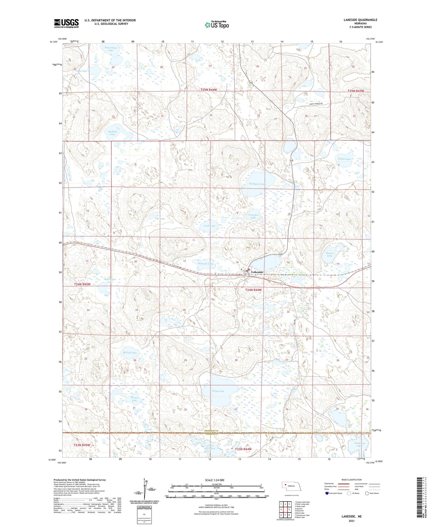
2021 topographic map quadrangle Lakeside in the state of Nebraska. Scale: 1:24000. Based on the newly updated USGS 7.5' US Topo map series, this map is in the following counties: Sheridan, Garden. The map contains contour data, water features, and other items you are used to seeing on USGS maps, but also has updated roads and other features. This is the next generation of topographic maps. Printed on high-quality waterproof paper with UV fade-resistant inks.
Quads adjacent to this one:
West: Antioch
Northwest: Krause Lake East
North: Peter Long Lake
Northeast: White Lake
East: Ellsworth
Southeast: Black Lake
South: Schoonover Lake
Southwest: Beck Lake
Contains the following named places: Ashburger Lake, Cat Lake, Chain of Lakes, Cody Lake, Cook Lake, Crowther Lake, Floyd Lake, Hancock Lake, Harris Lake, Heart of the Hills Rural Fire Department, Lakeside, Lakeside Post Office, Lakeside Public School, McFall Lake, Mulhall Lake, Patterson Lakes, Simondson Lake, Strong Lake, Thompson Lake, Welsh Lake, ZIP Code: 69351