MyTopo
Antioch Nebraska US Topo Map
Couldn't load pickup availability
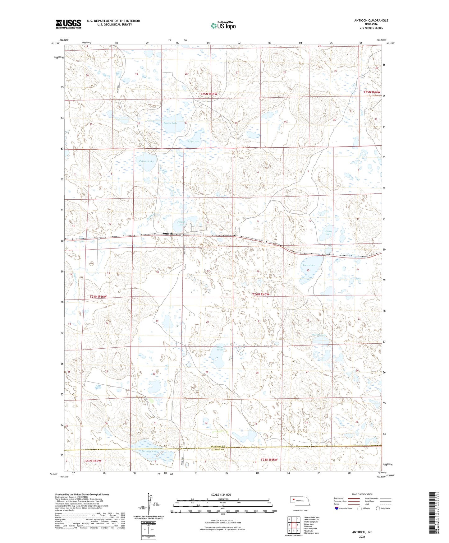
2021 topographic map quadrangle Antioch in the state of Nebraska. Scale: 1:24000. Based on the newly updated USGS 7.5' US Topo map series, this map is in the following counties: Sheridan, Garden. The map contains contour data, water features, and other items you are used to seeing on USGS maps, but also has updated roads and other features. This is the next generation of topographic maps. Printed on high-quality waterproof paper with UV fade-resistant inks.
Quads adjacent to this one:
West: Jesse Lake
Northwest: Krause Lake West
North: Krause Lake East
Northeast: Peter Long Lake
East: Lakeside
Southeast: Schoonover Lake
South: Beck Lake
Southwest: McCarthy Lake
This map covers the same area as the classic USGS quad with code o42102a5.
Contains the following named places: Antioch, Antioch Post Office, Antioch Potash Boom-Town Historical Marker, Antioch Public School, Bower Lake, Forester Lake, Hiers Lakes, Johnston Ranch, Lane Lake, Lily Lake, McFall Lake, McFall Ranch, Nelson Lake, Palmer Lake, Potash Lake, Wilson Lake