MyTopo
Laurel Nebraska US Topo Map
Couldn't load pickup availability
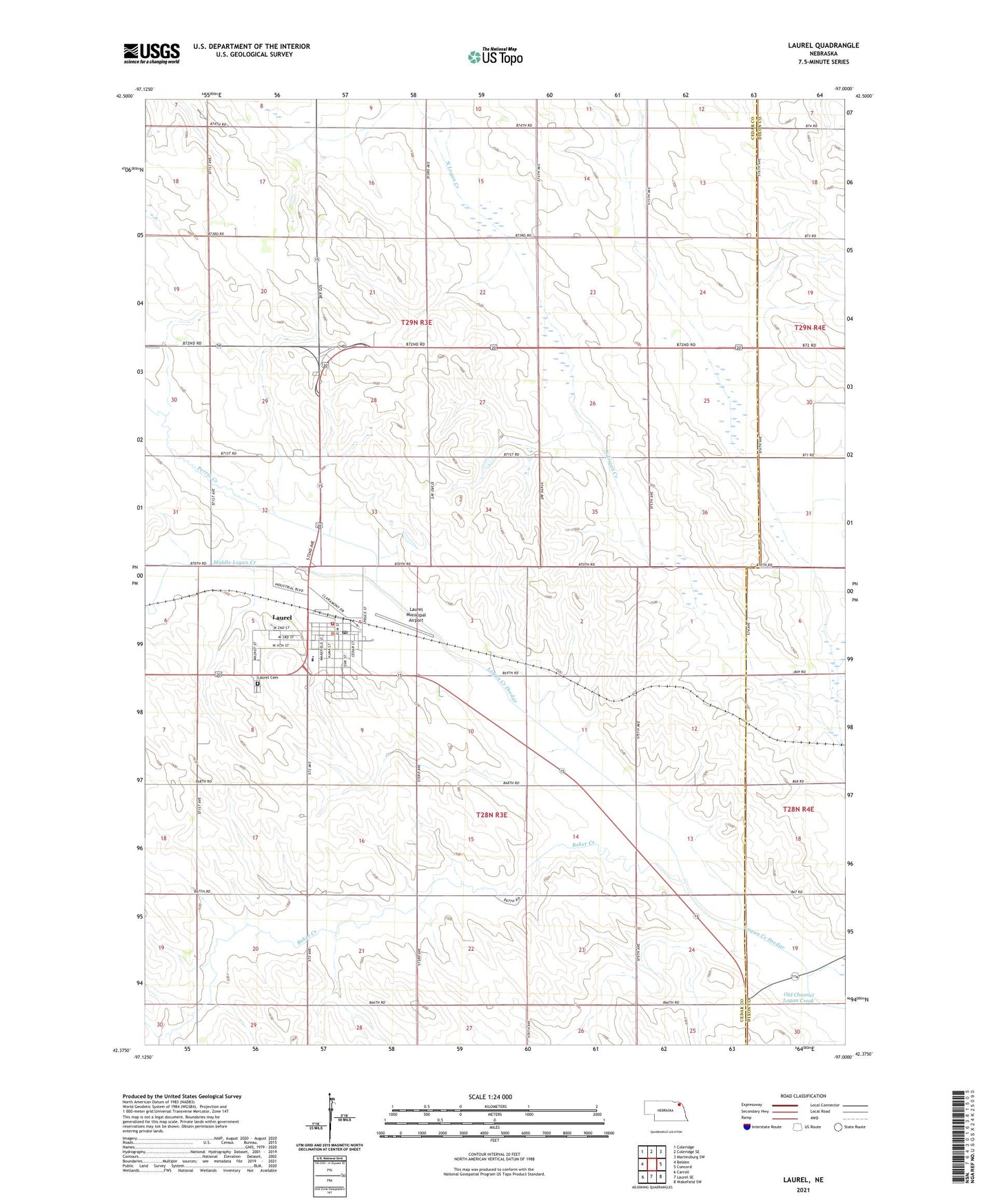
2021 topographic map quadrangle Laurel in the state of Nebraska. Scale: 1:24000. Based on the newly updated USGS 7.5' US Topo map series, this map is in the following counties: Cedar, Dixon. The map contains contour data, water features, and other items you are used to seeing on USGS maps, but also has updated roads and other features. This is the next generation of topographic maps. Printed on high-quality waterproof paper with UV fade-resistant inks.
Quads adjacent to this one:
West: Belden
Northwest: Coleridge
North: Coleridge SE
Northeast: Martinsburg SW
East: Concord
Southeast: Wakefield SW
South: Laurel SE
Southwest: Carroll
This map covers the same area as the classic USGS quad with code o42097d1.
Contains the following named places: Baker Creek, Cedar View Country Club, Church of the Open Bible, City of Laurel, Election Precinct 15, Election Precinct 21, Golden Prairie School, Hillcrest Care Center, Immanuel Lutheran Church, Laurel, Laurel Ambulance, Laurel Cemetery, Laurel City Park, Laurel City Park Campground, Laurel Family Dentistry, Laurel Feed and Grain Company Elevator, Laurel Fire Department, Laurel Lions Club Park, Laurel Lions Club Park Campground, Laurel Medical Clinic, Laurel Municipal Airport, Laurel Post Office, Laurel Public Library, Laurel-Concord Public Schools, Logan Center Church, Middle Logan Creek, North Side Grain Company Elevator, Northeast Nebraska Medical Group, Perrin Creek, Saint Marys Church, United Lutheran Church, United Methodist Church, United Presbyterian Church, ZIP Code: 68745