MyTopo
Mariaville Nebraska US Topo Map
Couldn't load pickup availability
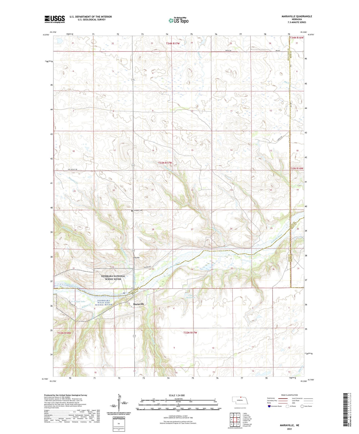
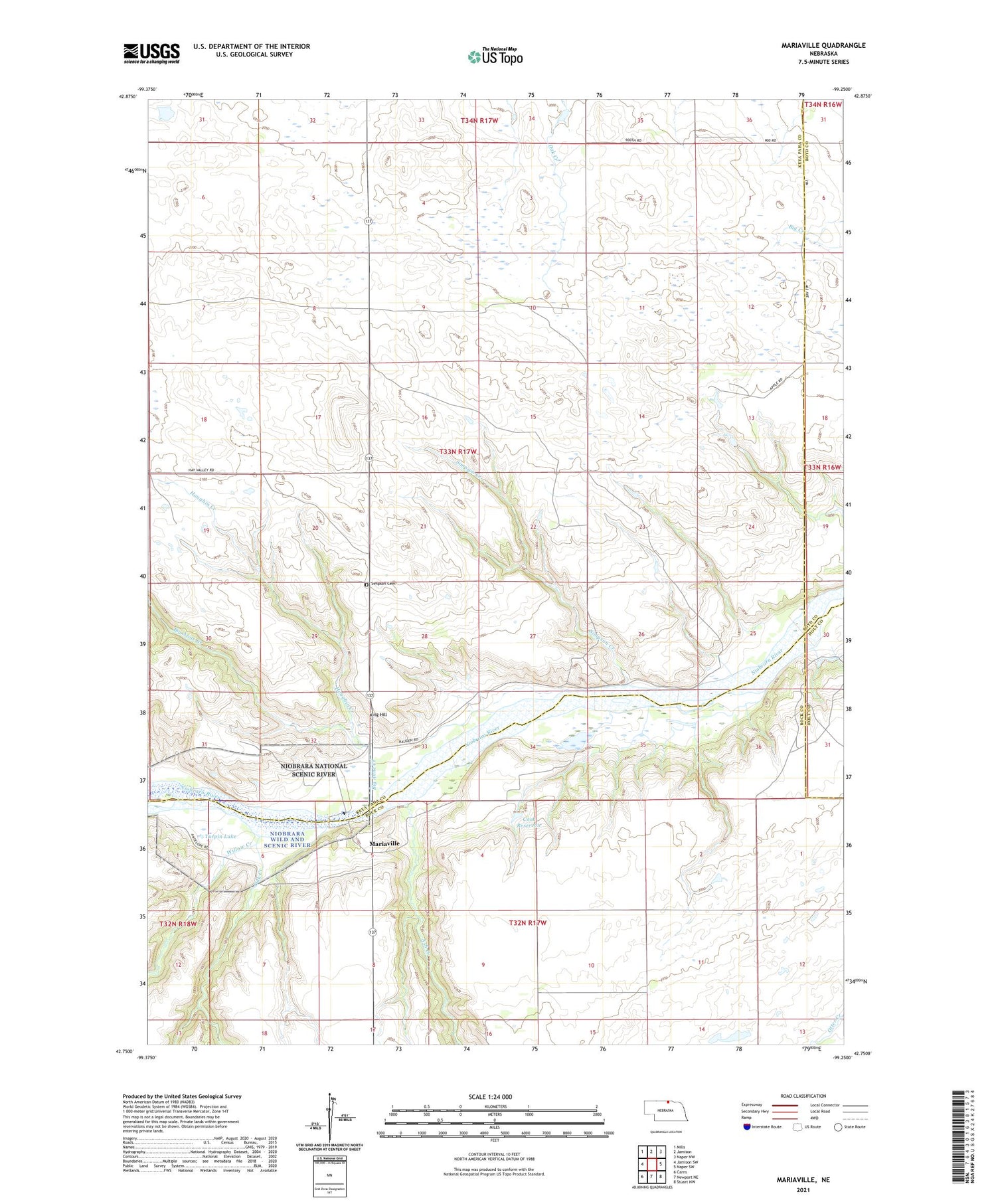
2021 topographic map quadrangle Mariaville in the state of Nebraska. Scale: 1:24000. Based on the newly updated USGS 7.5' US Topo map series, this map is in the following counties: Keya Paha, Rock, Boyd, Holt. The map contains contour data, water features, and other items you are used to seeing on USGS maps, but also has updated roads and other features. This is the next generation of topographic maps. Printed on high-quality waterproof paper with UV fade-resistant inks.
Quads adjacent to this one:
West: Jamison SW
Northwest: Mills
North: Jamison
Northeast: Naper NW
East: Naper SW
Southeast: Stuart NW
South: Newport NE
Southwest: Carns
Contains the following named places: Ash Creek, Big Anne Creek, Cook Dam, Cook Reservoir, Haughin Creek, King Hill, Mariaville, Mariaville Post Office, Oak Creek, School Number 14, School Number 69, School Number 86, Simpson Cemetery, Simpson Creek, Turpin Lake, Willow Creek