MyTopo
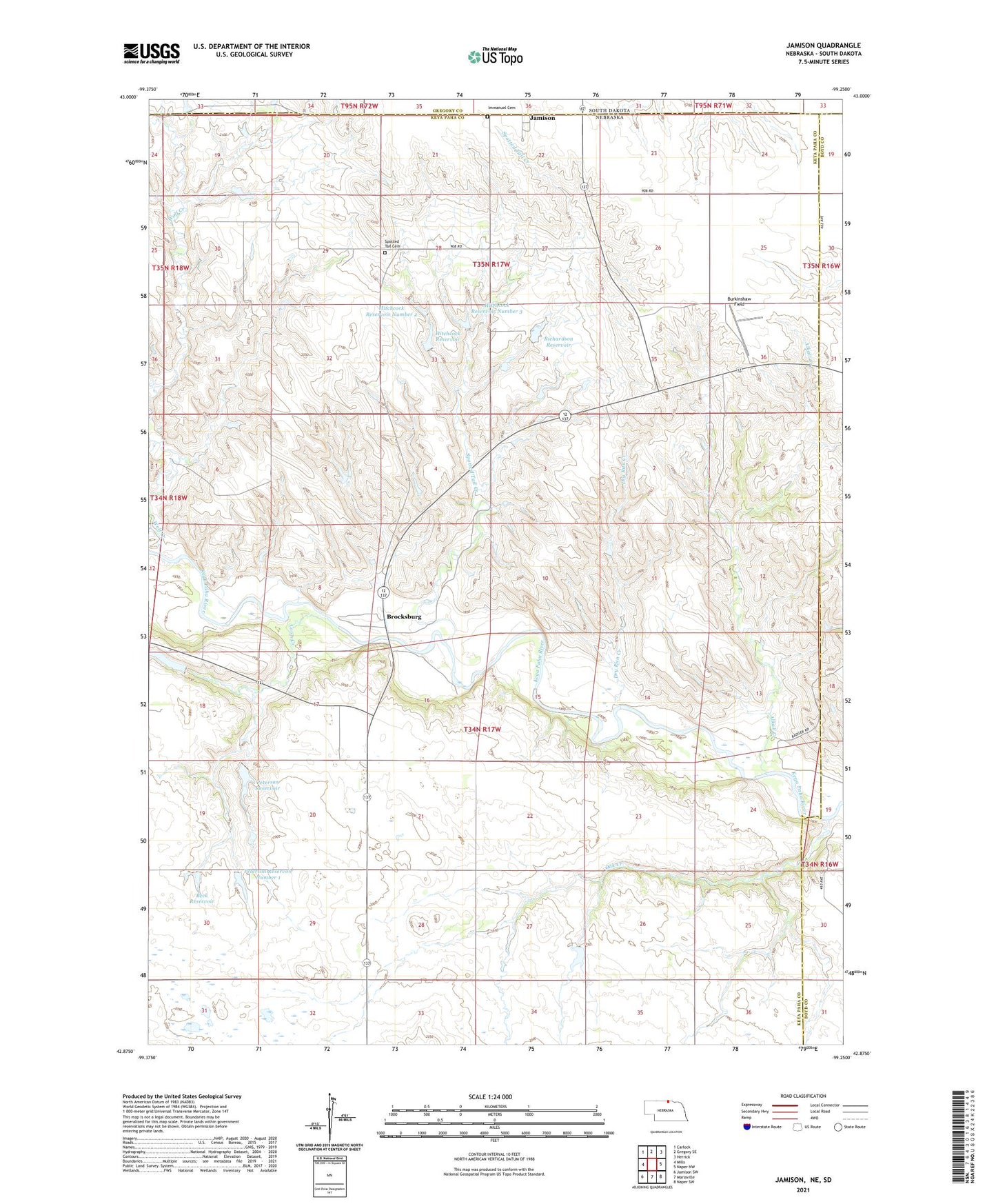
Jamison Nebraska US Topo Map
Couldn't load pickup availability
2021 topographic map quadrangle Jamison in the states of Nebraska, South Dakota. Scale: 1:24000. Based on the newly updated USGS 7.5' US Topo map series, this map is in the following counties: Keya Paha, Boyd, Gregory. The map contains contour data, water features, and other items you are used to seeing on USGS maps, but also has updated roads and other features. This is the next generation of topographic maps. Printed on high-quality waterproof paper with UV fade-resistant inks.
Quads adjacent to this one:
West: Mills
Northwest: Carlock
North: Gregory SE
Northeast: Herrick
East: Naper NW
Southeast: Naper SW
South: Mariaville
Southwest: Jamison SW
Contains the following named places: Alkali Creek, Beck Dam, Beck Reservoir, Brocksburg, Brocksburg Post Office, Burkinshaw Field, Coon Creek, Dry Run Creek, Gospel Tabernacle Church, Hitchcock Dam, Hitchcock Dam Number 2, Hitchcock Dam Number 3, Hitchcock Reservoir, Hitchcock Reservoir Number 2, Hitchcock Reservoir Number 3, Immanuel Cemetery, Jamison, Jamison Post Office, Oak Creek, Peterson Dam, Peterson Dam Number 1, Peterson Reservoir, Peterson Reservoir Number 1, Pleasant View School, Richardson Dam, Richardson Reservoir, Spotted Tail Cemetery, Spotted Tail Creek, Spotted Tail School, Wolf Creek