MyTopo
Mason City Nebraska US Topo Map
Couldn't load pickup availability
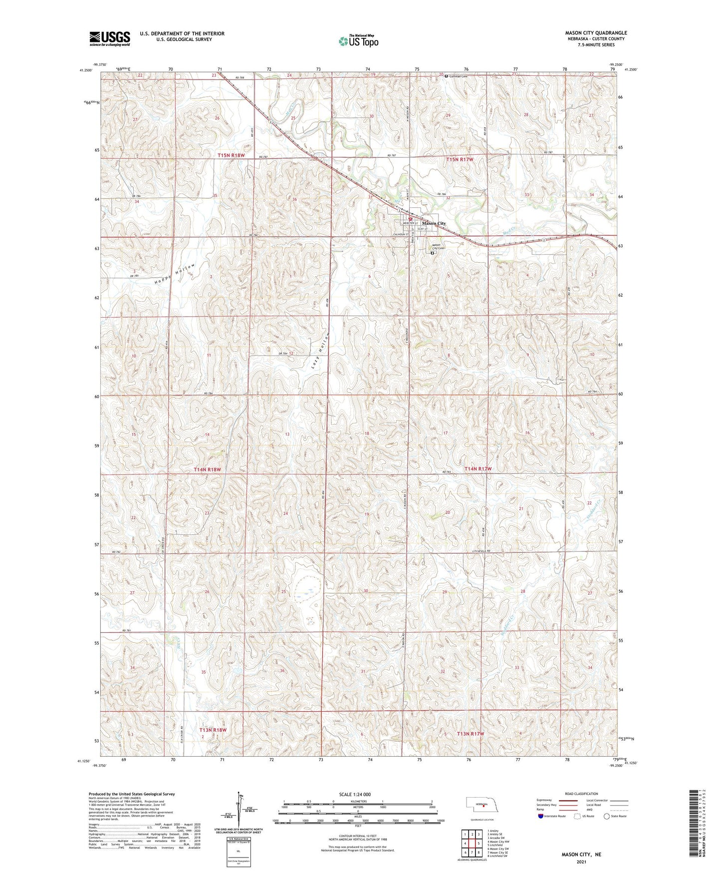
2021 topographic map quadrangle Mason City in the state of Nebraska. Scale: 1:24000. Based on the newly updated USGS 7.5' US Topo map series, this map is in the following counties: Custer. The map contains contour data, water features, and other items you are used to seeing on USGS maps, but also has updated roads and other features. This is the next generation of topographic maps. Printed on high-quality waterproof paper with UV fade-resistant inks.
Quads adjacent to this one:
West: Mason City NW
Northwest: Ansley
North: Ansley SE
Northeast: Arcadia SW
East: Litchfield
Southeast: Litchfield SW
South: Mason City SE
Southwest: Mason City SW
Contains the following named places: Algernon Post Office, Algernon School, American Missionary Fellowship, Beechville Post Office, Beechville School, Happy Hollow, Happy Hollow School, Lazy Hollow, Lazy Hollow School, Mason City, Mason City Post Office, Mason City Public School, Mason City Rescue Service, Mason City Rural Volunteer Fire Department, Mount Pleasant School, Saint Thomas Church, Township of Algernon, Union Hill School, Village of Mason City, ZIP Code: 68855