MyTopo
Ansley Nebraska US Topo Map
Couldn't load pickup availability
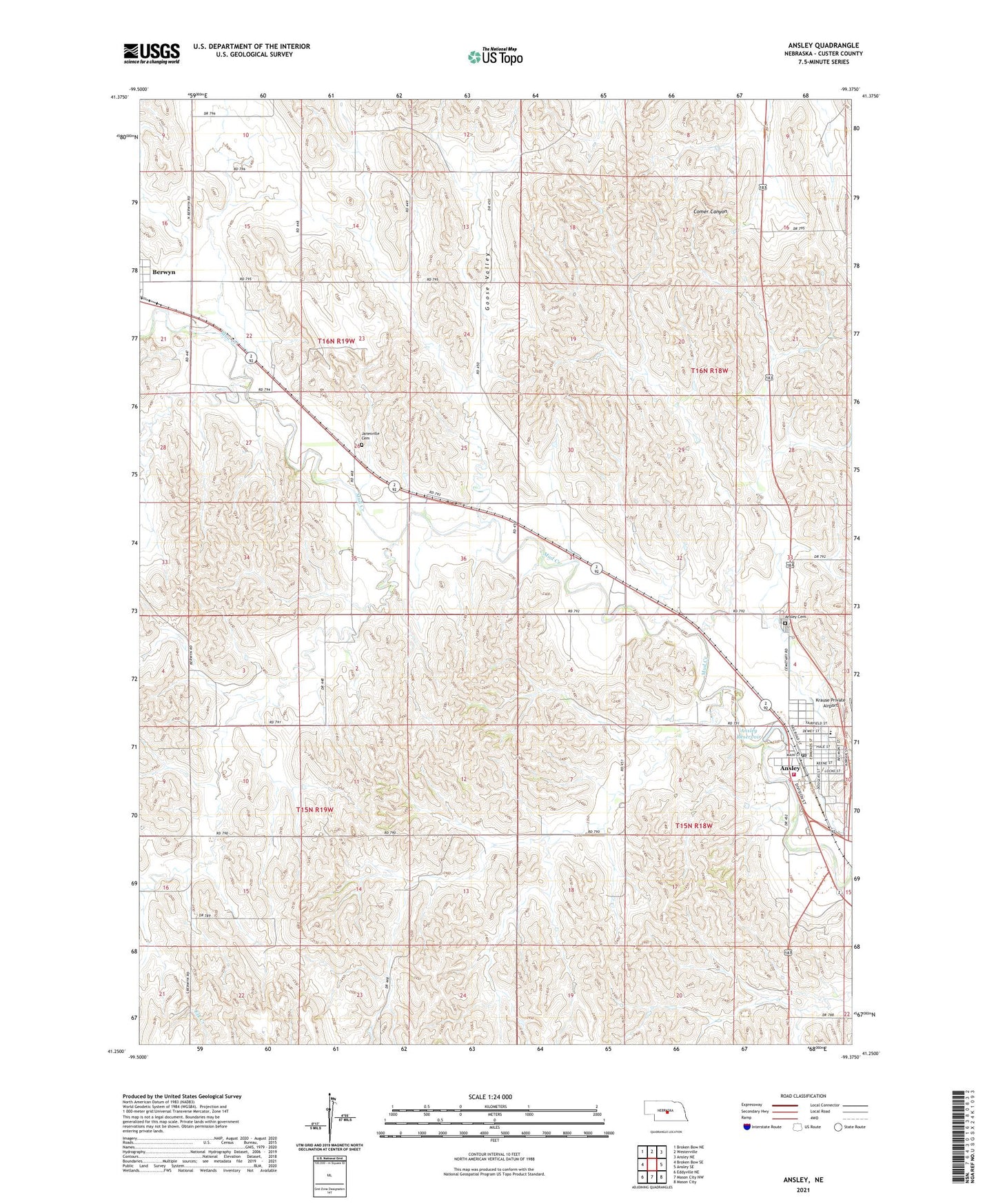
2021 topographic map quadrangle Ansley in the state of Nebraska. Scale: 1:24000. Based on the newly updated USGS 7.5' US Topo map series, this map is in the following counties: Custer. The map contains contour data, water features, and other items you are used to seeing on USGS maps, but also has updated roads and other features. This is the next generation of topographic maps. Printed on high-quality waterproof paper with UV fade-resistant inks.
Quads adjacent to this one:
West: Broken Bow SE
Northwest: Broken Bow NE
North: Westerville
Northeast: Ansley NE
East: Ansley SE
Southeast: Mason City
South: Mason City NW
Southwest: Eddyville NE
This map covers the same area as the classic USGS quad with code o41099c4.
Contains the following named places: Ansley, Ansley Cemetery, Ansley City Park, Ansley Clinic, Ansley Fire and Rescue, Ansley Historical Marker, Ansley Park Dam, Ansley Post Office, Ansley Public Schools, Ansley Reservoir, Baptist Church, Berwyn, Berwyn Post Office, Christian Church, First Baptist Church, Fundamental Baptist Church, Gonge School, Goose Valley, Goose Valley School, Harris School, Janesville Cemetery, Janesville School, Krause Private Airport, Sacred Heart Catholic Church, Spencer Park School, Township of Ansley, United Methodist Church, Village of Ansley, ZIP Code: 68814