MyTopo
Mills Nebraska US Topo Map
Couldn't load pickup availability
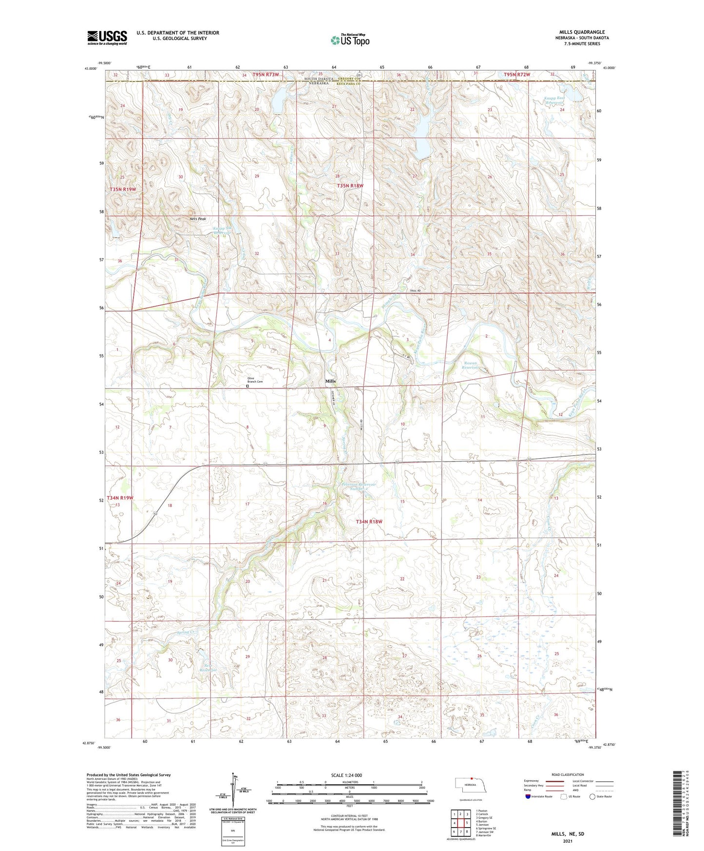
2021 topographic map quadrangle Mills in the state of Nebraska. Scale: 1:24000. Based on the newly updated USGS 7.5' US Topo map series, this map is in the following counties: Keya Paha, Gregory. The map contains contour data, water features, and other items you are used to seeing on USGS maps, but also has updated roads and other features. This is the next generation of topographic maps. Printed on high-quality waterproof paper with UV fade-resistant inks.
Quads adjacent to this one:
West: Burton
Northwest: Paxton
North: Carlock
Northeast: Gregory SE
East: Jamison
Southeast: Mariaville
South: Jamison SW
Southwest: Springview SE
Contains the following named places: Dry Creek, Indian Creek, Kaupp Dam Number 4, Kaupp Dam West, Kaupp East Dam, Kaupp East Reservoir, Kaupp Reservoir Number 4, Kaupp Reservoir West, Kaupp SW Dam, Kaupp SW Reservoir, Mills, Mills Community Church, Mills Election Precinct, Mills Post Office, Mills Public School, Nets Peak, Olive Branch Cemetery, Peterson Dam Number 2, Peterson Reservoir Number 2, Rowan Dam, Rowan Reservoir, Serr Dam, Serr Reservoir, Shingle Creek, ZIP Code: 68753