MyTopo
Gregory SE South Dakota US Topo Map
Couldn't load pickup availability
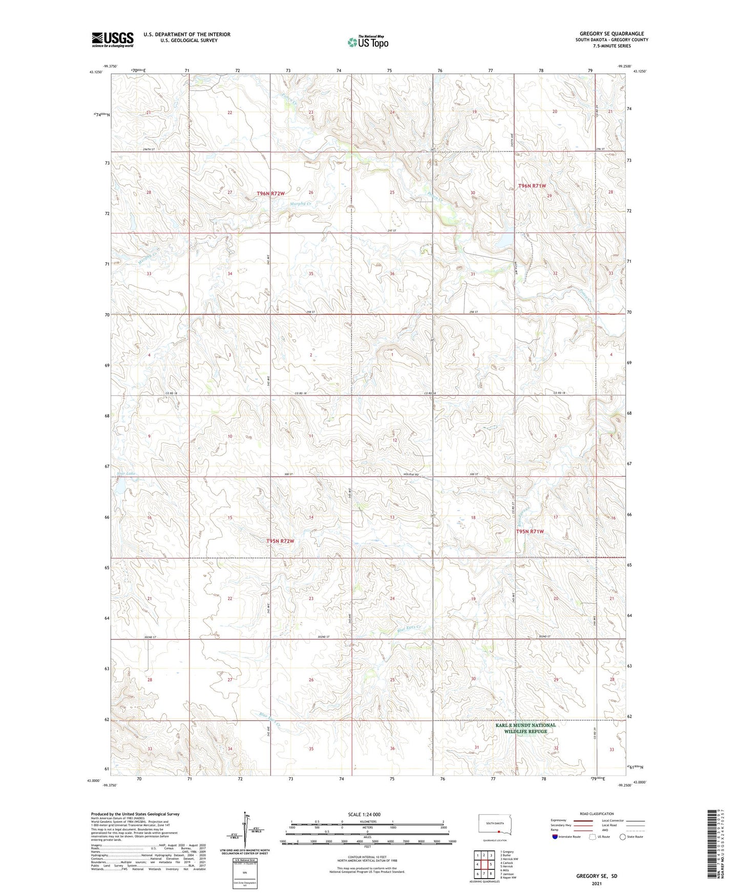
2021 topographic map quadrangle Gregory SE in the state of South Dakota. Scale: 1:24000. Based on the newly updated USGS 7.5' US Topo map series, this map is in the following counties: Gregory. The map contains contour data, water features, and other items you are used to seeing on USGS maps, but also has updated roads and other features. This is the next generation of topographic maps. Printed on high-quality waterproof paper with UV fade-resistant inks.
Quads adjacent to this one:
West: Carlock
Northwest: Gregory
North: Burke
Northeast: Herrick NW
East: Herrick
Southeast: Naper NW
South: Jamison
Southwest: Mills
This map covers the same area as the classic USGS quad with code o43099a3.
Contains the following named places: Allum School, Kaupp Hereford Ranch Number 2 Dam, Klug School, Lutz School, McCumber School, Murphy Creek, Neuharth School, Ponca Issue Station, Star Lake, Star Lake Dam, Township of Lone Star, Unorganized Territory of West Gregory